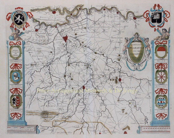
s Hertogenbosch Willem en Joan Blaeu 1634 - 1635
Willem Janszoon Blaeu
€ 1.650
Inter-Antiquariaat Mefferdt & De Jonge
- About the artworkBEROEMDE WAPENKAART VAN DE MEIERIJ VAN DEN BOSCH “Quarta Pars Brabantiae cujus caput Sylvaducis“[het vierde deel van Brabant met als hoofdstad ‘s-Hertogenbosch], kopergravure van het oostelijke deel van Noord-Brabant, gecentreerd op Den Bosch en Eindhoven, uitgegeven te Amsterdam door Willem en Joan Blaeu als deel van Le Theatre du Monde ou Nouvel Atlas, 1634-1635. In de tijd met de hand gekleurd. Afm. 41,5 x 52 cm. Deze zgn. ‘wapenkaart’ van de Meierij van ‘s-Hertogenbosch, vervaardigd door Willebordus van der Burght, is vanwege zijn decoratieve wapenschilden en nauwkeurige topografische gegevens een van de meest geliefde kaarten uit de atlassen van de firma Blaeu. Behalve de wapenschilden van Brabant en Den Bosch (met twee Brabantse en twee Limburgse leeuwen) bovenaan, zien we de wapens van Helmond, Eindhoven, Graafschap Megen, het Land van Ravestein en Grave. Prijs: Euro 1.650,- (incl lijst)
- About the artist
"Willem Janszoon Blaeu and his son Joan epitomised the 'golden age' of Dutch cartography. Working during the seventeenth century, Willem Blaeu drew a number of ground-breaking maps and published the first atlas.
He was born in 1571 in Amsterdam and worked initially as a clerk in the family herring trade. However, he was not happy with his occupation and left home in 1594 to study mathematics under Tycho Brahe, the famous astronomer. Blaeu was a good student who much impressed his tutor, and when his studies were completed he returned to Amsterdam and set up business as a map maker. His business flourished and his reputation grew. He was the first map-maker to produce single sheet maps of many European countries.
In 1605 he made a wall map of the world, encompassing 20 sheets, each 8 feet across. This map was by far the most accurate of the period and made an outstanding contribution to knowledge of world geography.
His map remained the most accurate until 1648, when his son, Joan, who also became a famous map-maker, updated it. But his major achievement was the production of the first atlas in 1630. The name Blaeu was actually a family nickname which Willem took up after confusion had occurred between himself and his great rival Joannes Jansonius."
Are you interested in buying this artwork?
Artwork details
Related artworks
- 1 - 4 / 8
- 1 - 4 / 24
- 1 - 4 / 12

