Mapa del mundo 1587
Abraham Ortelius
€ 5.500
Inter-Antiquariaat Mefferdt & De Jonge
- Sobre la obra de arteONE OF THE GREAT WORLD MAPS OF ALL TIME "Typus Orbis Terrarum." Copper engraving from Theatrum Orbis Terrarum. Published by Arbraham Ortelius of Antwerp from 1587 onwards. With original (?) hand colouring. Size: 35,5 x 48,5 cm. One of the most famous of world maps, from Ortelius' great work, Theatrum Orbis Terrarum. Initially published in 1570, this volume was the first that could truly be called an ‘atlas’ in the modern sense of a compilation of maps engraved to a uniform format according to the most up-to-date information available. The publication of the Theatrum also marked the inauguration of the era of Dutch supremacy in cartography. For these and other reasons, Abraham Ortelius is called the "father of modern cartography." This particular map is based upon Gerard Mercator's large world map of 1569. Ortelius' atlas project had the blessing and aid of Mercator, who supplied Ortelius with coordinates of places in America. Although the map appears rather erroneous to modern eyes, it actually contains some of the best compilation work of the period, which was a hallmark of mapmaking in the sixteenth century. In the north, islands are shown surrounding the North Pole, and separated from America and Asia by a sea passage, the latter being a popular belief in the sixteenth century. In the south, a large "Terra Australis Nondum Cognita" is drawn, separated from South America by the "Estrecho di Magallanes." “From surviving correspondence it is known that Mercator generously encouraged Ortelius to make use of his published corpus of research; he also provided him with coordinates of places in America and perhaps elsewhere.” – Shirley In 1587 Ortelius updated this seminal map for the third and last time. South America now assumes a more accurate shape, and the Solomon Isles are marked for the first time. The updated map is also distinctive and especially beautiful for the four medallions in the corners with classical texts, two from Cicero and two from Seneca. The border of this map is altered as well, now with a more intricate and elegant lattice of strapwork and swag. Altogether with the embellishments, rich colour and important information, one of the great world maps of all time. Literature: “Ortelius atlas maps”, Marcel van den Broecke, Ort3; “The Mapping of the World”, Rodney Shirley, no. 158, plate 130. Price: Euro 5.500,- (incl. frame)
- Sobre el artista
Abraham Ortelius nació en Amberes en 1527. Fue un famoso cartógrafo y geógrafo del sur de los Países Bajos. Ortelius fue el fundador del Atlas moderno y puede ser visto como uno de los grandes geógrafos de su tiempo. La familia de Ortelius se originó en la ciudad alemana de Augsburgo. En 1547 Ortelius actuó como colorador de mapas en el gremio de Saint-Lucas en Amberes. Vivió brevemente en Inglaterra y Lieja después de 1576 por razones políticas. Después de esto regresó a Amberes donde vivió hasta su muerte en 1598.
¿Está interesado en comprar esta obra de arte?
Artwork details
Categoría
Related artworks
- 1 - 4 / 5
Artista Desconocido
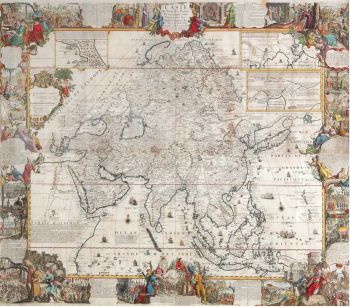
A large wall map of Asia by Nicolas de Fer 1647 - 1720
Precio a consultarZebregs & Röell - Fine Art - Antiques
1 - 4 / 24- 1 - 4 / 12


