North Holland - Johannes Dou, 1729 by Johannes Dou
Scroll to zoom, click for slideshow

North Holland - Johannes Dou, 1729 1729

Johannes Dou

PapierImprimer
86 ⨯ 112 cm
€ 3.250

Inter-Antiquariaat Mefferdt & De Jonge

  • Sur l'oeuvre d'art
    WALL MAP OF NORTH HOLLAND “’T Hoogheemraadschap vande Uytwaterende Sluysen in Kennemerlant ende West-Frieslant” [The Hoogheemraadschap (water board) of Uitwaterende Sluizen in Kennemerland and West Friesland], copper engraving after the design of Johannes Dou I, published in Amsterdam by Andries and Hendrik de Leth in 1729. Coloured by a later hand. Four sheets joined. Size: 86 × 112 cm. This map is a characteristic example of Dutch water management cartography. To protect the low-lying Holland polderland — situated in a deep basin — from the waters of the sea and rivers, a large number of waterschappen (water boards) were established throughout western Netherlands, each responsible for hydraulic works and flood protection within its district. For efficient water management, accurate overview maps were of vital importance. The Dijkgraaf (dike reeve) and High Heemraden (board members) of the water board of the Uitwaterende Sluizen in Kennemerland and West Friesland commissioned the surveyor and mapmaker Johannes Dou I (1615–1682) to chart their jurisdiction in the northern part of Holland. Dou spent an astonishing twenty years on the project, completing in 1682 an enormous map composed of sixteen sheets. Two years later, a reduced version on four sheets was produced, as well as a smaller single-sheet edition. All three versions of the map were engraved by Koenraet Decker (1651–1709), a pupil of Romeyn de Hooghe and Abraham Deur. Although their names appear only on the sixteen-sheet edition, it has been shown that the copperplates were reused and copied multiple times, both individually and in sets of three maps. While the cartographic content remained unchanged, small variations can be found in the coats of arms of the water board officials. Based on the heraldry on this particular copy — those of Dijkgraaf Aris van der Mienden, and Hoogheemraden Gijsbert Ramp, Claas Swaan, Cornelis van Eyck, Adriaan Warmenhuisen, and Rentmeester en Secretaris (land agent and secretary) Johan Baert — we can date this example to 1729. Johannes Dou I was admitted as a land surveyor by the Hof van Holland (High Court of Holland) on 10 September 1635. He studied at the University of Leiden, and after his father’s death in 1635 he was appointed, together with Steven van Broeckhuysen, as permanent surveyor of the Hoogheemraadschap van Rijnland. From 1637 onwards he also practised as a notary public. Literature: o.a. Donkersloot - de Vrij, Topografische kaarten van Nederland vóór 1750, p. 147-148, no. 751. Price: Euro 3.250,-
  • Sur l'artiste

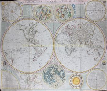
    Johannes Dou, également connu sous le nom de Jan Jansz., ou Douw (Leiden, 7 février 1615 - 5 mars 1682) était un géomètre qui travaillait principalement pour le Rijnland Water Board.

    Johannes Dou est né à Leiden en 1615 (selon son père le 7 février) en tant que fils de Jan Pieterszoon Dou et Josina Sadelaer. Le 8 mars 1634, Johannes était inscrit à l'Université de Leiden en tant qu'étudiant en mathématiques.

    Il a assisté à des conférences avec Frans van Schoten sr., professeur de 'Duytsche mathematicque', la formation d'ingénieurs, de constructeurs de forteresses et de géomètres. Son père était un éminent arpenteur-géomètre avec une grande production, qui a également publié plusieurs livres sur son domaine.

    Il a probablement appris à son fils ce dont il avait besoin dans la pratique. Quoi qu'il en soit, le 10 septembre 1635, Johannes est admis par la Cour de Hollande à exercer la profession d'arpenteur-géomètre. En 1637, il est nommé notaire.

    Après la mort de son père en 1635, Dou a été nommé avec Steven van Broeckhuizen comme arpenteur-géomètre de Rijnland et à partir de 1637 apparaît également comme notaire à Leiden. Comme son père, il était extrêmement productif, mais n'a jamais atteint sa stature scientifique.

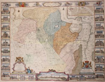
    En plus de nombreuses petites commandes, il s'est également distingué avec quelques œuvres plus de bon goût. Par exemple, en 1661, il a conçu le canal de Leiden à Utrecht, il a été déployé en 1672 lors de la campagne contre les Français et en 1675, il a terminé sa grande carte de l'Uitwaterende Sluizen.

Êtes-vous intéressé par l'achat de cette oeuvre?

Artwork details