China, Korea, Japan - Mercator/Hondius, 1619 by Jodocus Hondius
Scroll to zoom, click for slideshow

China, Korea, Japan - Mercator/Hondius, 1619 1619

Jodocus Hondius

Carta
34 ⨯ 47 cm
€ 2.150

Inter-Antiquariaat Mefferdt & De Jonge

  • A proposito di opere d'arte
    ONE OF THE MOST SOUGHT AFTER MAPS OF CHINA "China" Copper engraving made by Gerard Mercator published in Amsterdam by Jodocus II and Henricus Hondius in 1619. Verso Latin text. With original (?) hand colouring. Size: 34 x 47 cm. Of the lands in the Far East, China was seen as the wealthiest and most mysterious and the Jesuit missionairies were among the first to make the dangerous journey. Geographically the map is an interesting array of fact and fiction. The map contains rudimentary geographical information, as there was very little actually known of the region during the early part of the seventeenth century. The two most prominent features of this survey are the portrayal of the peninsula of Korea and the charming illustration China's great wall ((400 leagues in lenght, it protects the Chinese empire against the tartares), a wonder of both ancient and modern worlds. There is also a note porporting to be the location of "where the emperor of China has his seat". Despite the odd elongation of the country, there are attemps to show various provinces, and several great cities are marked. The interior of China is dominated by several large lakes and the mythical "Chiamai Lacus" forms the headwaters of five large rivers in northeastern India. The northwest coastline of America appears in the upper top corner with a notation that refers to (again) the Tartar hordes (and the deer and wolves) that inhabit the region. As ever in these early maps seamonsters stalk unwary ships and Hondius shows a European merchant sailing on what is labeled as "Chinensis Oceanus". This ocean is portrayed with an elaborate and beautiful pattern which attempts to portray the movement of the waves. The islands of Japan also feature on this beautiful map, together with the portrayal of how a Japanese 'criminal' is tied (ie not nailed) to a cross and is speared by a European for killing Christians. The persistance of the Jesuits wanting to spread Christianity in Japan, ultimately led to the fact that foreigners were driven out and from 1616 foreign trade (with the exception of China) was limited to the ports of Hirado and Nagasaki. (Where the Dutch - who were not missionaries, but traders - were the only ones to do business with Japan for more than two centuries.) On the left of the map is a land yacht (as is often the case on early depictions of China), with the note that the Chinese are an inventive people and that they had fabricated a wagon that could sail on the wind across the plains. Marco Polo swore were they in common use at the time. Jodocus Hondius (1563-1612) was the founder of the famous 17th century Dutch map publishing family. Hondius, along with sons Jodocus II and Henricus and son-in-law Jan Janssonius, was prominent in Dutch cartography and competed with the emerging Blaeu family map business. When Jodocus Hondius acquired the copperplates of Gerard Mercator's atlas, he prepared this map for inclusion in his Atlas sive Cosmographicae…, first published in 1606. This map is from the edition dated 1619 (Ref.: Koeman Me26B). Price: EUR 2.150,-
  • A proposito di opere artista

    Jodocus Hondius (17 ottobre 1563 – 12 febbraio 1612), noto anche con la forma latinizzata del suo nome olandese Joost de Hondt, fu un incisore e cartografo fiammingo e una delle figure più significative dell'età d'oro della cartografia olandese. Per distinguerlo dal figlio, viene spesso chiamato Jodocus Hondius il Vecchio.

    Hondius raggiunse la fama grazie alla sua eccezionale capacità di combinare l'abilità tecnica dell'incisione con la cultura geografica. È noto soprattutto per le sue prime e influenti mappe dell'Europa e del Nuovo Mondo, che contribuirono a plasmare la comprensione visiva europea dei territori appena esplorati all'inizio del XVII secolo. Le sue mappe sono caratterizzate da chiarezza, precisione e ricchezza di dettagli decorativi, qualità che le resero sia autorevoli documenti scientifici che opere d'arte molto ambite.

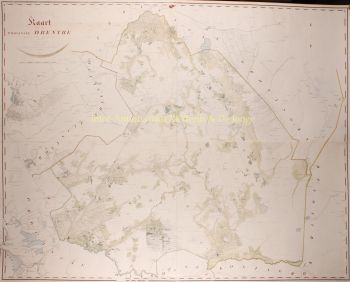
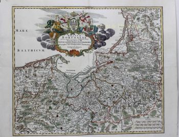
    Un momento cruciale nella carriera di Hondius fu l'acquisizione delle lastre da stampa originali di Gerardo Mercatore. In un'epoca in cui la reputazione di Mercatore stava iniziando a svanire, Hondius ripubblicò e ampliò queste tavole, integrando le proprie revisioni e le nuove conoscenze geografiche disponibili. Questo atto non solo fece rivivere l'eredità di Mercatore, ma ne garantì anche un'influenza duratura, dando vita ai celebri atlanti Mercatore-Hondius che avrebbero dominato la cartografia europea per decenni.

    Oltre alla cartografia, Hondius fu anche un abile incisore di ritratti. I suoi ritratti di Francis Drake sono tra le rappresentazioni visive più riconoscibili del celebre navigatore inglese, a ulteriore dimostrazione della versatilità e della portata culturale di Hondius.

    Come una delle figure centrali dell'Età d'Oro della cartografia olandese (circa 1570-1670), Hondius svolse un ruolo cruciale nell'affermazione di Amsterdam come il principale centro cartografico nell'Europa del XVII secolo. La sua opera unì arte, scienza e commercio, plasmando il modo in cui il mondo veniva mappato, compreso e immaginato. Oggi, Jodocus Hondius il Vecchio è ricordato come un maestro incisore, un editore innovativo e un architetto chiave della storia cartografica moderna.

Sei interessato ad acquistare questa opera d'arte?

Artwork details

Categoria
Soggetto
Stile
Materiale e Tecnica