Wind chart, anemographical map by Johannes Janssonius
Scroll to zoom, click for slideshow

Wind chart, anemographical map 1650

Johannes Janssonius

ImprimirGravação
43.50 ⨯ 54.50 cm
€ 2.250

Inter-Antiquariaat Mefferdt & De Jonge

  • Sobre arte
    WIND ROSE BY JANSSON, ONE OF THE EARLIEST ANEMOGRAPHIC CHARTS "Tabula Anemographica seu Pyxis Nautica Ventorum nomina sex linguis repraesentans" [Anemographic charts or nautical wind compass representing the names of the winds in six languages], copper engraving published by Johannes Janssonius (a.k.a. Jan Jansson) in 1650 as part of his "Groote Atlas, vervattende de Water-Weereld" [gand atlas, including the water world]. Coloured by a later hand. Size: 43.5 x 54.5 cm. "This chart depicts the sea compass with the magnetic needle, which sailors use on the wild and raging sea, where one sees nothing but sky and water and has no given path before them, and thus determine their true course and may find the places where they wish to sail." This chart was made during a time when directional observation was changing, a time when transitioning from a wind rose to a compass rose. In ancient Greece - before the invention of the magnetic compass - sailors defined directions based on the different winds and where they came from. Homer spoke of four main wind directions, but as navigation and cartography developed further, more directions were added. Names for wind directions were named after gods, constellations of stars, or weather conditions in Greek, Latin, and other languages. The use of different names for the same wind directions made it even more confusing. This "Table of Winds" provided a solution. On a 360° compass, 32 wind directions are indicated with names in Dutch, French, Italian, Latin, and Greek. Each wind is represented by a blowing figure with the characteristics of the people from the area where the wind was associated. The main wind directions are depicted larger. The top left quadrant represents the north: bearded Germanic or Scandinavian types. Top right are the winds from the east: beardless, dark men. The smooth faces from the south and west are less easily identifiable but probably represent the Greeks and indigenous inhabitants of America. So-called anemographic charts like this were functional and used as references. Sea charts already existed in the 17th century, but much use was made of sailors' guides in which (as text) it might say, for example, "follow the southwest wind for three days," then "go with the east wind." A seafarer could consult a chart like this to determine the sailing direction. Price: Euro 2.250,- (incl. frame)
  • Sobre artista

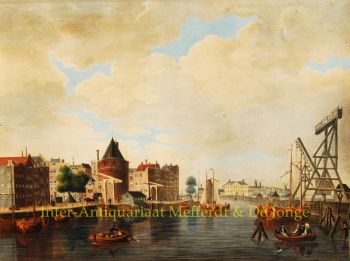
    Janssonius nasceu em Arnhem como filho de Jan Jansz, um impressor e editor de lá. Ainda jovem mudou-se para Amsterdã, então centro da impressão e do comércio de cartões. Em 1612 ele se casou com Elisabeth Hondius, filha de Jodocus Hondius. Elisabeth morreu em 1627 e Janssonius casou-se novamente em 1629 com Elisabeth Carlier. Ele foi trabalhar para o sogro e continuou o negócio editorial junto com Henricus Hondius (filho de) após sua morte. Este foi desenvolvido em um dos maiores de seu tempo. Havia filiais em Berlim, Frankfurt, Genebra, Lyon e Estocolmo, entre outras.

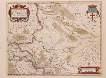
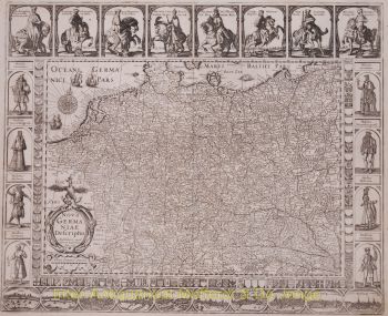
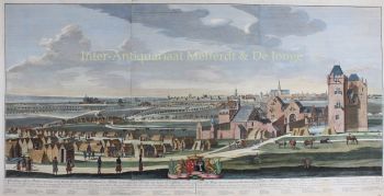
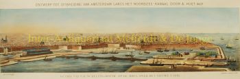
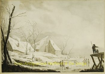
    Sob a liderança de Janssonius, o Mercator-Hondius Atlas foi expandido e publicado como Atlas Novus. Esta edição inicialmente de um volume logo se tornou um atlas de vários volumes, complementado a pedido com cartas náuticas e/ou cartas celestes. Houve publicações em holandês, francês, espanhol e latim. Assim como seus contemporâneos, Janssonius também fez uso de placas de cobre existentes, incluindo as dos livros da cidade de Braun & Hogenberg e a Description de touts les Pays Bas (Descrição de todos os Países Baixos) de Lodovico Guicciardini - (edição Cornelis Claesz.) de 1609 Embora Janssonius tenha sido frequentemente acusado de copiar o trabalho de Willem Blaeu, pode-se notar que os mapas de Janssonius também apareceram no mercado anteriormente.

    Após a morte de Janssonius, a empresa foi continuada por seu genro, Johannes (Jan) van Waesbergen, que era casado com sua filha Elisabeth Janssonius (1615-1681). Muitas placas de cobre dos livros da cidade foram usadas (às vezes ligeiramente modificadas) por Frederik de Wit. O prédio na Praça Dam foi alugado para Gerard Valck; Ele também comprou várias chapas de impressão em 1694.

Você está interessado em comprar esta obra de arte?