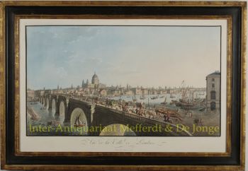
Sumatra 1657
Johannes Janssonius
€ 850
Inter-Antiquariaat Mefferdt & De Jonge
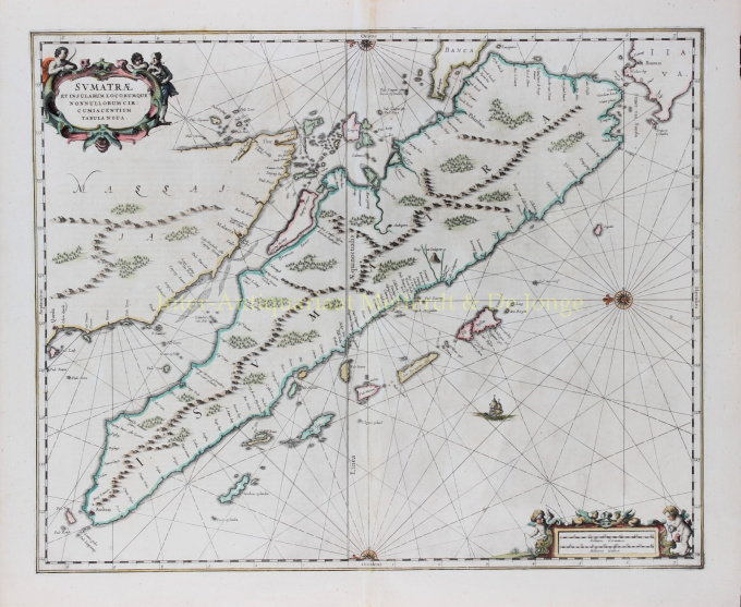
- Über KunstwerkFINE CHART OF SUMATRA AND THE SOUTHERN COASTS OF MALAYSIA. “Sumatrae et Insularum Locorumque Nonnullorum Circumiacentium Tabula Nova.” Copper engraving published by Johannes Janssonius (Jan Jansson) of Amsterdam in 1657 as part of his Atlas Novus. With original hand colouring. Size: 49 x 58 cm. North is orientated to the left of the page. Singapore is probably identified just to the south of Ihor (Johor Bahru) as Senasur. As the map appeared in an atlas of sea charts, little interior detail is given but the coastlines, settlements and principal coastal features are identified. It is one of the earliest detailed depictions of Sumatra and remained the most important map of the region until well into the eighteenth century. A sailing ship and two cartouches embellish the chart: a title cartouche with three allegorical figures and a mileage scale with two surveying putti. In earlier times, Sumatra had been mistaken for the Island of Sri Lanka or Taprobana. The name Taprobana, had been applied to maps of Sumatra from the fifteenth century, after a misunderstanding by the Italian traveller Nicolo de Conti. De Conti dismissed the idea that Sri Lanka was Taprobana and so identified Sumatra as the mythical island described by geographers as Eratosthenes, Strabo, Pliny, Claudius Ptolemy and Cosmas. Price: €850,-
- Über Künstler
Janssonius wurde in Arnheim als Sohn des dortigen Druckers und Verlegers Jan Jansz geboren. In jungen Jahren zog er nach Amsterdam, dem damaligen Zentrum des Druck- und Kartenhandels. 1612 heiratete er Elisabeth Hondius, Tochter des Jodocus Hondius. Elisabeth starb 1627 und Janssonius heiratete 1629 erneut mit Elisabeth Carlier. Er arbeitete für seinen Schwiegervater und führte nach dessen Tod zusammen mit Henricus Hondius (Sohn von) die Verlagsgeschäfte weiter. Diese wurde zu einer der größten ihrer Zeit ausgebaut. Niederlassungen gab es unter anderem in Berlin, Frankfurt, Genf, Lyon und Stockholm.
Unter der Leitung von Janssonius wurde der Mercator-Hondius-Atlas erweitert und als Atlas Novus veröffentlicht. Aus dieser zunächst einbändigen Ausgabe wurde bald ein mehrbändiger Atlas, auf Wunsch ergänzt durch Seekarten und/oder Himmelskarten. Es gab Veröffentlichungen in Niederländisch, Französisch, Spanisch und Latein. Ebenso wie seine Zeitgenossen bediente sich Janssonius auch vorhandener Kupferplatten, unter anderem aus den Stadtbüchern von Braun & Hogenberg und der Description de touts les Pays Bas (Beschreibung der ganzen Niederlande) von Lodovico Guicciardini – (Edition Cornelis Claesz.) aus 1609 Obwohl Janssonius oft beschuldigt wurde, Willem Blaeus Werke kopiert zu haben, sei darauf hingewiesen, dass auch Karten von Janssonius schon früher auf dem Markt erschienen.
Nach dem Tod von Janssonius wurde die Firma von seinem Schwiegersohn, Johannes (Jan) van Waesbergen, der mit seiner Tochter Elisabeth Janssonius (1615-1681) verheiratet war, weitergeführt. Viele Kupferplatten der Stadtbücher wurden (manchmal leicht modifiziert) von Frederik de Wit verwendet. Das Gebäude am Dam-Platz wurde an Gerard Valck verpachtet; 1694 kaufte er auch eine Reihe von Druckplatten.
Sind Sie daran interessiert, dieses Kunstwerk zu kaufen?
Artwork details
Related artworks
- 1 - 4 / 4
- 1 - 4 / 24
- 1 - 4 / 12

