Artois 1656
Nicolaes Visscher
€ 175
Inter-Antiquariaat Mefferdt & De Jonge
- About the artwork
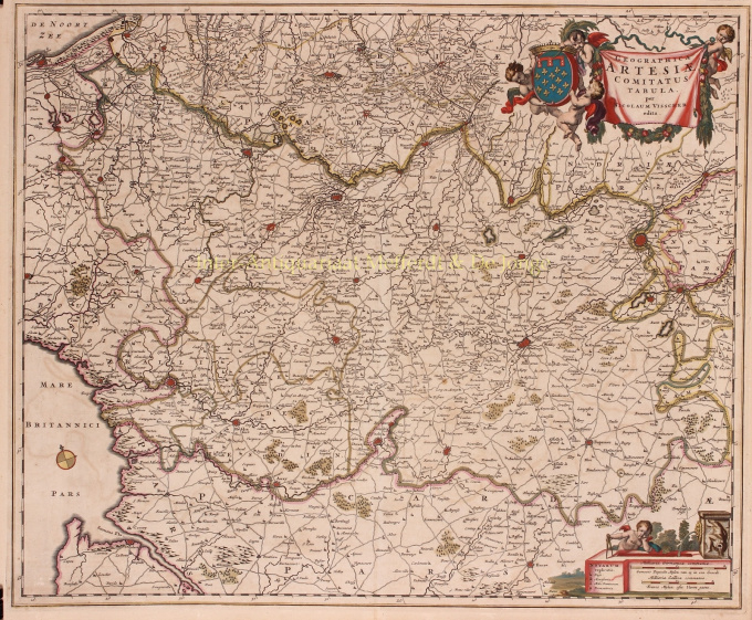
GRAAFSCHAP ARTESIA (ARTOIS) "Geographica Artesiae Comitatus Tabula", copper engraving published in Amsterdam by Nicolaes Visscher I as part of his "Atlas Contractus" between 1656-1677. Verso: blank. Coloured by hand in time. Dim. 46.6 x 56.3 cm. The County of Artesia was one of the Seventeen Provinces in the 16th century. Artesia played an important role at the beginning of the Eighty Years' War. Together with Hainaut, Artesia took the initiative for the Southern Union of Atrecht (Arras). Although the Flemish and Brabant cities sided with the northern Union of Utrecht, the division of the Netherlands had begun, with a northern part striving for independence from the Spanish king and a southern part wishing to remain with the Spanish empire. At the end of the Eighty Years' War, Artesia was conquered from the Spaniards by the French. At the Peace of the Pyrenees in 1659, Artesia was definitively allocated to France. At the top right, putti carry a banderole with the title of the map and the county's coat of arms. A dreamy putto with compass rests on the legend and scale bars bottom right. Price: Euro 175
- About the artist
Nicolaes was the only son of Claes Jansz. Fisher. He is also known by the names: Nicolaas or Claes Claesz. After years of working for his father in the business, he succeeded him after his death in 1652. In 1662 he was admitted to the Amsterdam booksellers' guild and in 1677 Nicolaes, by now a respected publisher, received a 15-year patent from the states of Holland and West Friesland for the printing and publishing of maps. He died two years later and was buried in the same chapel as his father.
Atlas editions of Nicolaes I included:
"Atlas Contractus Orbis Terrarum" from 1657.
“Germania Inferior” from 1663.
“Atlas Minor” from 1675.
Visscher's atlases were often compiled according to the wishes of the buyers (the so-called Atlas Contractus). They generally contain no text, only sometimes a printed index. Cards from other makers were used, self-engraved and worked copper plates from his father.One of the highlights of seventeenth-century cartography is the multi-page wall map. An example of this - from 1656 - is the map of Zeeland: “Zelandiae Comitatus novissima Tabula”. This consisted of nine sheets that together had a size of 140 x 160 cm. By adding cityscapes, the map could be enlarged even further. These cityscapes were in turn published around 1668 under the name: “Speculum Zelandiae”.
Are you interested in buying this artwork?
Artwork details
Related artworks
- 1 - 4 / 4
- 1 - 4 / 24
- 1 - 4 / 12

