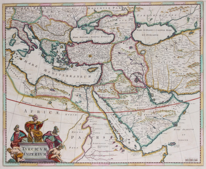
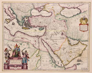
Ottoman Empire map 1680
Frederick de Wit
€ 800
Inter-Antiquariaat Mefferdt & De Jonge
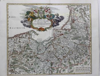
- About the artworkOTTOMAN EMPIRE MAP "Turcicum Imperium". Copper engraving published by Frederick de Wit in Amsterdam, approx. 1680. Original hand colouring. Size: 45,4 x 55,7cm. Nice old color example of De Wit's map of the Turkish Empire, based upon Blaeu's map of a similar title. The map covers the Ottoman Empire at the height of its power. The map extends from Sardinia and Italy in the West to the Black & Caspian Seas in the North and the Gulf of Aden, Red Sea and Arabian peninsula in the South. It is filled with place names, topographical features, and notes. It is embellished with a fine title cartouche with three Ottomans. Price: Euro 800,-
- About the artist
Frederik de Wit was born Frederik Hendriksz. He was born to a Protestant family in about 1629, in Gouda, a small city in the province of Holland, one of the seven united provinces of the Netherlands. His father Hendrik Fredericsz (1608 – 29 July 1668) was a hechtmaecker (knife handle maker) from Amsterdam, and his mother Neeltij Joosten (d. before 1658) was the daughter of a merchant in Gouda. Frederik was married on 29 August 1661, to Maria van der Way (1632–1711), the daughter of a wealthy Catholic merchant in Amsterdam. From about 1648 until his death at the end of July 1706, De Wit lived and worked in Amsterdam. Frederik and Maria had seven children, but only one Franciscus Xaverius (1666–1727) survived them.
By 1648, during the height of the Dutch Golden Age, De Wit had moved from Gouda to Amsterdam. As early as 1654, he had opened a printing office and shop under the name "De Drie Crabben" (the Three Crabs) which was also the name of his house on the Kalverstraat. In 1655, De Wit changed the name of his shop to the "Witte Pascaert" (the White Chart). Under this name De Wit and his firm became internationally known.
Are you interested in buying this artwork?
Artwork details
Related artworks
- 1 - 4 / 4
- 1 - 4 / 24
- 1 - 4 / 12

