South America, Tierra del Fuego  by Reinier & Joshua Ottens
Scroll to zoom, click for slideshow

Sud America, Terra del Fuoco 1745

Reinier & Joshua Ottens

€ 1.250

Inter-Antiquariaat Mefferdt & De Jonge

  • A proposito di opere d'arte
    “Tractus Australior Americae Meridionalis a Rio de la Plata per Fretum Magellanicum ad Toraltum / Nieuwe Perfecte Pascaert van 't Suyderlyckfte deel van Suyt America, van Rio de la Plata door de straet Magellaen tot Toral.” Copper engraving published in Amsterdam by Reinier and Josua Ottens in around 1745. Coloured by a later hand. Size: approx. 48,5 x 56 cm. Beautiful sea chart of South America, extending from Rio de la Plata to the Magellan Strait and Tierra del Fuego archipelago. The dramatic cartouche depicts an encounter between Tierra del Fuego natives and Dutch explorers, where natives show the wealth of their land: (melted) gold and cattle. The Dutch merchant Jacob le Maire and his captain Willem Schouten rounded Cape Horn in 1616 on their way to discover a route towards the East Indies. A naval battle unfolds in the South Atlantic, presumably a scene from the Second Anglo-Dutch War. The chart, first published by Frederick de Wit,  is one of the most elegant and detailed charts of South America published in the 17th Century and was likely engraved by Romeyn de Hooghe. Our map is a re-issue from the early 18th century by the Ottens family. Price: Euro 1.250,-
  • A proposito di opere artista

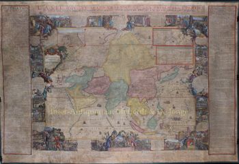
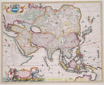
    Il periodo dal 1630 al 1700 fu il "periodo d'oro" della cartografia olandese. Le mappe erano percepite come opere d'arte, il lavoro manuale era molto apprezzato, l'incisione era ai massimi livelli, ma dal punto di vista dell'accuratezza geografica, le mappe dei maestri olandesi erano inferiori alle mappe prodotte in Germania, Francia e altri paesi europei .

    Joachim, il fondatore della ditta Ottens, è nato ad Amsterdam e inizialmente ha lavorato come incisore su rame. Nel 1711 fondò la propria ditta che si occupava di editoria e tipografia, vendendo libri, mappe, cartoline e illustrandoli.

    Sebbene Joachim morì pochi anni dopo, i suoi figli, Renier e Joshua, continuarono con successo l'attività del padre. Il contributo più significativo alla cartografia della famiglia Ottens furono gli enormi atlanti multivolume che realizzarono su ordinazione, come Atlas Major. Alcuni numeri di Atlas sono composti da più di 800 mappe emesse separatamente.

Sei interessato ad acquistare questa opera d'arte?

Artwork details