China 1695
Covens and Mortier
Inter-Antiquariaat Mefferdt & De Jonge
- Über Kunstwerk“Imperii Sinarum Nova Descriptio” [The Chinese Empire newly described]. Copper engraving published by Johannes Covens and Pieter Mortier around 1695. Verso: blank. Coloured by a later hand. Size: 46 x 59 cm. This great map of the Chinese Empire was based on the compilation of the Jesuit father Martino Martini who traveled through the region between 1643 and 1650. Martini was the Jesuit Superior in Hangchow, giving him access to indigenous and Jesuit surveys of all the regions of China. It was a period of great internal unrest and his was a perilous journey. He was able to travel inland to the Great Wall and for the first time determined with any scientific accuracy the astronomical position of many cities and topographical features. After establishing a mission in Zhejiang province he returned to Rome via Amsterdam, where he met publisher Joan Blaeu. Blaeu then prepared a group of eight maps covering China in great detail for the “Atlas Sinensis”, the first western atlas of China China is mapped with considerable accuracy for the period: the Great Wall is shown. The map incorporates the discoveries of Joao da Gama and Maarten Gerritsz de Vries. Korea for the first time on a European map is no longer depicted as an island but as a peninsula. The depiction of Japan follows a Portugese map by Christopher Blancus and Ignacio Moreira from 1617, but it is the first map to name and show Hokkaido (here “Ieso”) as an island to the north of Honshu. The map was first issued by Joan Blaeu, and then part of the plates acquired by Covens & Mortier at the end of the 17th century and re-issued with a new privilege by the Covens & Mortier firm. Price: Euro 1.450,-
- Über Künstler
Covens and Mortier (1721 - ca. 1862) war ein Amsterdamer Verlag, der Nachfolger des umfangreichen Verlagsimperiums, das von Pierre Mortier (1661 - 1711) aufgebaut wurde.
Covens und Mortier Map werden oft als abgeleitet kritisiert – aber das ist nicht vollständig der Fall. Pierre Mortier lebte von 1681 bis 1685 in Paris. Dort knüpfte er enge Beziehungen zu den größten französischen Kartographen seiner Zeit, darunter De L'Isle und D'Anville.
Sein Geschäftsmodell basierte auf der Nutzung niederländischer Drucktechnologie und Raffinesse, um hochmoderne französische Kartographie mitzuveröffentlichen. Nach Mortiers Tod im Jahre 1711 wurde seine Firma von seinem Sohn Cornelius Mortier (1699 - 1783) übernommen. Cornelius heiratete 1721 die Schwester von Johannes Covens (1697 - 1774) und gründete zusammen mit seinem Schwager die Firma Covens and Mortier.
Unter dem Covens- und Mortier-Aufdruck setzten Cornelius und Johannes Pierres Modell fort, die aktuellsten französischen Werke mit Erlaubnis zu veröffentlichen. Sie wurden schnell zu einem der größten und produktivsten niederländischen Verlagsunternehmen des 18. Jahrhunderts.
Die Firma und ihre Nachfolger veröffentlichten Tausende von Karten über einen Zeitraum von 120 Jahren von 1721 bis Mitte des 19. Jahrhunderts. Während ihrer langen Lebensdauer veröffentlichte die Firma Covens and Mortier als Covens and Mortier (1721–1778), J. Covens and Son (1778–94) und Mortier, Covens and Son (1794–ca. 1862).
Sind Sie daran interessiert, dieses Kunstwerk zu kaufen?
Artwork details
Related artworks
- 1 - 4 / 7
- 1 - 4 / 24
Jan Voerman sr
Still Life with flowers in a Chinese figurine1850 - 1900
Precio a consultarKunsthandel Pygmalion
Artista Desconocido
Series of 6 Chinese cups and saucers (Yongzheng period)1722 - 1735
Precio a consultarKuipers Kunst & Antiek
1 - 4 / 24Jean Metzinger
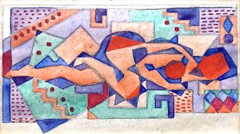
Cubist nude lying with bent leg, circa 19201910 - 1920
Precio a consultarGallerease Selected
1 - 4 / 24- 1 - 4 / 12


