Seventeen Provinces 1635
Willem Janszoon Blaeu
TintePapierDruck
40 ⨯ 50 cm
€ 1.450
Inter-Antiquariaat Mefferdt & De Jonge
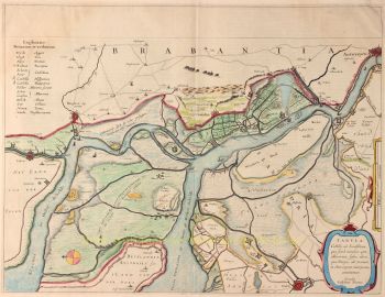
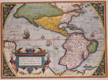
- Über KunstwerkFAMOUS MAP OF THE SEVENTEEN PROVINCES “Novus XVII Inferioris Germaniæ Provinciarvm Typvs de integro multis in locis emendatus à Guliel. Blaeu.” Copper enrgaving made by Josua vanden Ende, here in its 3rd state published by Willem Bleau in 1635. Verso: French text. With original hand colouring. Size: 40 x 50,5 cm. The bottom right shows a cartouche with scale bar and the address of Willem Blaeu: "op 't Water in de Vergulde Zonnewyzer" [current day Damrak in Amsterdam]. On the left a cartouche a list of towns and villages per province and a legend of the symbols used. In the North Sea we see a 32-piece compass rose, a sea monster and many ships. The Fall of Antwerp in 1585 caused a de facto separation between the Northern and Southern Netherlands and the seventeen provinces split into two parts. A border arose whereby the Seventeen Provinces were split into the Republic of the Seven United Netherlands and the Southern Netherlands. Because of emigration and a change in the political situation, the economic center of The Netherlands shifted to the north. The Dutch Revolt against the Spaniards continued and meanwhile religion divided the entire continent into two parts. All of Europe was now at war, and conflicts were not resolved until the Peace of Münster in 1648. In the treaty Dutch Republic was recognized by Spain as sovereign state. At that time, the separation of the northern and southern Netherlands was a fact. Nevertheless, maps of the Seventeen Provinces regularly occur up to about 1800. This was partly beacause of the enormous costs for the fieldwork and engraving that came with the production of new maps, but was also due to the unclear borders of the area in the east and south of the Dutch Republic. Reference: H.A.M. van der Heijden “Oude kaarten der Nederlanden, 1548-1794", map 64.3 Price: Euro 1.450,-
- Über Künstler
„Willem Janszoon Blaeu und sein Sohn Joan verkörperten das ‚goldene Zeitalter‘ der niederländischen Kartographie. Willem Blaeu arbeitete im 17. Jahrhundert, zeichnete eine Reihe bahnbrechender Karten und veröffentlichte den ersten Atlas.
Er wurde 1571 in Amsterdam geboren und arbeitete zunächst als Angestellter im Heringshandel der Familie. Er war jedoch mit seinem Beruf nicht zufrieden und verließ 1594 seine Heimat, um bei Tycho Brahe, dem berühmten Astronomen, Mathematik zu studieren. Blaeu war ein guter Schüler, der seinen Lehrer sehr beeindruckte, und als er sein Studium beendet hatte, kehrte er nach Amsterdam zurück und gründete ein Unternehmen als Kartenhersteller. Sein Geschäft florierte und sein Ruf wuchs. Er war der erste Kartenhersteller, der Einzelblattkarten vieler europäischer Länder produzierte.
1605 fertigte er eine Wandkarte der Welt an, die 20 Blätter mit jeweils 8 Fuß Durchmesser umfasste. Diese Karte war bei weitem die genaueste der Zeit und leistete einen herausragenden Beitrag zur Kenntnis der Weltgeographie.
Seine Karte blieb bis 1648 die genaueste, als sein Sohn Joan, der auch ein berühmter Kartenzeichner wurde, sie aktualisierte. Aber seine größte Errungenschaft war die Erstellung des ersten Atlas im Jahr 1630. Der Name Blaeu war eigentlich ein Spitzname der Familie, den Willem annahm, nachdem es zwischen ihm und seinem großen Rivalen Joannes Jansonius zu Verwechslungen gekommen war.
Sind Sie daran interessiert, dieses Kunstwerk zu kaufen?
Artwork details
Related artworks
- 1 - 4 / 8
- 1 - 4 / 24
Jean-François Rauzier
Veduta Amsterdam 1 - Limited edition of 8 2015
Preis auf AnfrageVilla del Arte Galleries
Jean-François Rauzier
Amsterdam Centraal - Limited edition of 8 2015
Preis auf AnfrageVilla del Arte Galleries
1 - 4 / 24Unbekannter Künstler
Zwei Studienporträts von Mas Marco Kartodikromo1900 - 1950
Preis auf AnfrageZebregs & Röell - Fine Art - Antiques
1 - 4 / 24- 1 - 4 / 12


