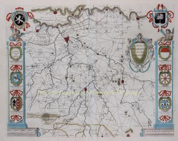
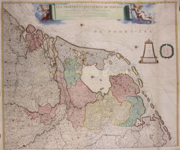
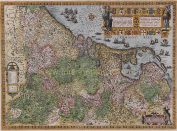
Seventeen Provinces 1635
Willem Janszoon Blaeu
InkPaperPrint
40 ⨯ 50 cm
€ 1.450
Inter-Antiquariaat Mefferdt & De Jonge
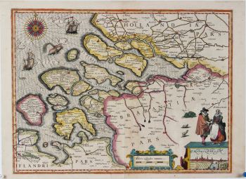
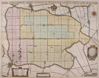
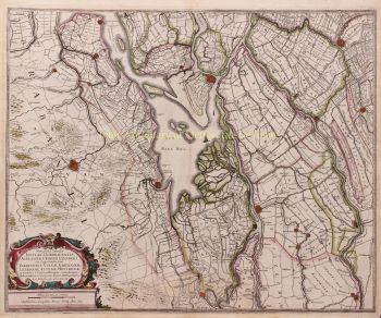
- About the artworkFAMOUS MAP OF THE SEVENTEEN PROVINCES “Novus XVII Inferioris Germaniæ Provinciarvm Typvs de integro multis in locis emendatus à Guliel. Blaeu.” Copper enrgaving made by Josua vanden Ende, here in its 3rd state published by Willem Bleau in 1635. Verso: French text. With original hand colouring. Size: 40 x 50,5 cm. The bottom right shows a cartouche with scale bar and the address of Willem Blaeu: "op 't Water in de Vergulde Zonnewyzer" [current day Damrak in Amsterdam]. On the left a cartouche a list of towns and villages per province and a legend of the symbols used. In the North Sea we see a 32-piece compass rose, a sea monster and many ships. The Fall of Antwerp in 1585 caused a de facto separation between the Northern and Southern Netherlands and the seventeen provinces split into two parts. A border arose whereby the Seventeen Provinces were split into the Republic of the Seven United Netherlands and the Southern Netherlands. Because of emigration and a change in the political situation, the economic center of The Netherlands shifted to the north. The Dutch Revolt against the Spaniards continued and meanwhile religion divided the entire continent into two parts. All of Europe was now at war, and conflicts were not resolved until the Peace of Münster in 1648. In the treaty Dutch Republic was recognized by Spain as sovereign state. At that time, the separation of the northern and southern Netherlands was a fact. Nevertheless, maps of the Seventeen Provinces regularly occur up to about 1800. This was partly beacause of the enormous costs for the fieldwork and engraving that came with the production of new maps, but was also due to the unclear borders of the area in the east and south of the Dutch Republic. Reference: H.A.M. van der Heijden “Oude kaarten der Nederlanden, 1548-1794", map 64.3 Price: Euro 1.450,-
- About the artist
"Willem Janszoon Blaeu and his son Joan epitomised the 'golden age' of Dutch cartography. Working during the seventeenth century, Willem Blaeu drew a number of ground-breaking maps and published the first atlas.
He was born in 1571 in Amsterdam and worked initially as a clerk in the family herring trade. However, he was not happy with his occupation and left home in 1594 to study mathematics under Tycho Brahe, the famous astronomer. Blaeu was a good student who much impressed his tutor, and when his studies were completed he returned to Amsterdam and set up business as a map maker. His business flourished and his reputation grew. He was the first map-maker to produce single sheet maps of many European countries.
In 1605 he made a wall map of the world, encompassing 20 sheets, each 8 feet across. This map was by far the most accurate of the period and made an outstanding contribution to knowledge of world geography.
His map remained the most accurate until 1648, when his son, Joan, who also became a famous map-maker, updated it. But his major achievement was the production of the first atlas in 1630. The name Blaeu was actually a family nickname which Willem took up after confusion had occurred between himself and his great rival Joannes Jansonius."
Are you interested in buying this artwork?
Artwork details
Related artworks
- 1 - 4 / 8
- 1 - 4 / 24
Antonie Derkinderen
Memory book Exhibition of Dutch Painting1892
Price on requestKunsthandel Pygmalion
1 - 4 / 24Theo Meier
“A Balinese woman with offerings”1936
Price on requestZebregs & Röell - Fine Art - Antiques
1 - 4 / 24- 1 - 4 / 12


