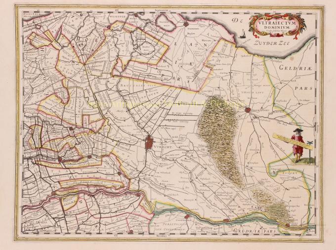
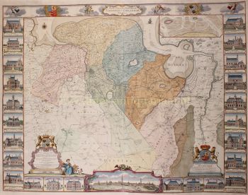
Utrecht / Gooi 1635
Willem Janszoon Blaeu
€ 650
Inter-Antiquariaat Mefferdt & De Jonge
- About the artwork
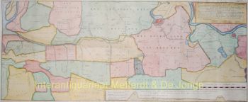
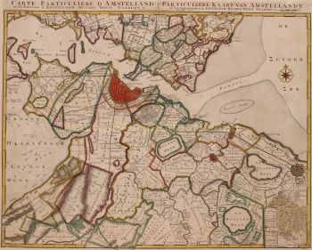
THE HOLIDAY OF UTRECHT "Ultrajectum Dominium". Copper engraving published in 1635 by Willem Blaeu. Verso: French text. Coloured by hand. Sizes 38 x 49,5 cm. Willem Blaeu made this map based on one by Balthasar Florisz. van Berckenrode from 1620. There were no country houses on the Vecht or in 's-Graveland at that time. Monasteries on the Vecht are still depicted, but by then they had already fallen into ruin. This was the time when canals were dug between towns and existing waterways were made suitable for towing ships. In 1599, a towpath was constructed along the Amstel River from Amsterdam to Uithoorn, and between 1626 and 1628 parts of the Amsterdam-Utrecht section were constructed. The first towpaths were constructed as connections between two cities, but in the course of the 17th century more and more separate towpaths were linked. This is how large canal networks came into being. From 1588 (until the French era), the Utrecht District was one of the provinces of the Republic of the Seven United Provinces. What the map does not tell you is that when it appeared, a plague epidemic was raging in Utrecht, which would not stop until 1638. As much as 15 percent of Utrecht's population would die as a result of this disease. Blaeu was inspired to make an atlas like no other in the world. Financial reasons were secondary; the risk was too great for that. But there was rivalry between the publishers of Blaeu and Janssonius and motives such as prestige and display were at least as important. He wanted to create something that would overwhelm the civilised world in the heyday of Amsterdam's power. Out of this ambition appeared the "Atlas Maior". Price: Euro 650,-
- About the artist
"Willem Janszoon Blaeu and his son Joan epitomised the 'golden age' of Dutch cartography. Working during the seventeenth century, Willem Blaeu drew a number of ground-breaking maps and published the first atlas.
He was born in 1571 in Amsterdam and worked initially as a clerk in the family herring trade. However, he was not happy with his occupation and left home in 1594 to study mathematics under Tycho Brahe, the famous astronomer. Blaeu was a good student who much impressed his tutor, and when his studies were completed he returned to Amsterdam and set up business as a map maker. His business flourished and his reputation grew. He was the first map-maker to produce single sheet maps of many European countries.
In 1605 he made a wall map of the world, encompassing 20 sheets, each 8 feet across. This map was by far the most accurate of the period and made an outstanding contribution to knowledge of world geography.
His map remained the most accurate until 1648, when his son, Joan, who also became a famous map-maker, updated it. But his major achievement was the production of the first atlas in 1630. The name Blaeu was actually a family nickname which Willem took up after confusion had occurred between himself and his great rival Joannes Jansonius."
Are you interested in buying this artwork?
Artwork details
Related artworks
- 1 - 4 / 8
- 1 - 4 / 24
- 1 - 4 / 12

