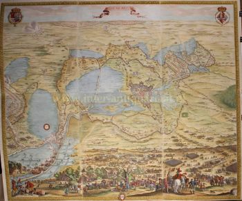
TRÈS RARE PREMIÈRE CARTE IMPRIMÉE D'AMSTERDAM, VILLE EN ASCENSION 1544
Cornelis Anthonisz Theunissen
Papier
100 ⨯ 103 cm
€ 175.000
Inter-Antiquariaat Mefferdt & De Jonge
- Sur l'oeuvre d'art
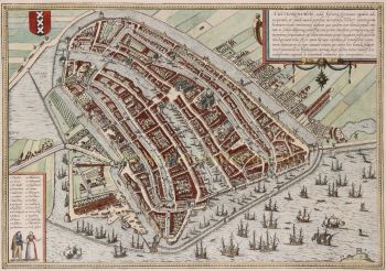
“De vermaerde koopstadt van Amstelredam” [The renowned trading city of Amsterdam], woodcut printed from twelve blocks, with text printed in letterpress, made in 1544 by Cornelis Anthonisz. Size (including decorative border): approx. 100.5 x 103.5 cm. In 1544, Amsterdam was part of the Habsburg Empire under Emperor Charles V. The city had only about 12,000 inhabitants, and construction was largely confined to the area within the Singel, a small part of the Amstel River, the Kloveniersburgwal, and the Geldersekade. There was no Grachtengordel ["canal belt"] as we know it today. The map shows developments in the Lastage, the area east of the Geldersekade. Here, just a stone's throw from the Oude Kerk, workers are active in shipyards and sawmills. This suggests that the city was beginning to build its trade over the water. The connection to shipping and trade, and implicitly its reliance on it, is further highlighted by the numerous ships depicted both within and beyond the wooden palisades in the IJ waterfront. Billowing sails, salutes from cannon shots, and small boats coming and going illustrate a city on the brink of becoming one of the world’s most important. To the west of the city (under clouds in the top right corner) are the market gardens that were later urbanized during the expansions of 1585-1586 and 1610-1615. Within the city walls, several buildings are visible, including the Schreierstoren, which still stands today. Also shown are several churches, the Munttoren (then part of the Regulierspoort), and the Waag on the Nieuwmarkt. Cornelis Anthonisz. is thought to have been inspired by a map of Venice, also in bird’s-eye view, created in 1500. Both maps are adorned with a mythological god; however, while the map of Venice features both Mercury and Neptune, Cornelis Anthonisz. includes only Neptune. Interestingly, this sea god on the Amsterdam map appears to be shouting, his mouth open, showing a less-than-perfect set of teeth. By choosing a high vantage point, Cornelis Anthonisz. skillfully combined detailed building depictions with an ability to show the layout of city walls, roads, river, and canals. An impressive feat, especially considering that Anthonisz. only had access to towers to view the city from a higher perspective. In his imagination, he flies above the city, peering over fences and observing city life. Midway along the Amstel, which divides the city, the Dam (with the old town hall) is clearly recognizable. Ships dock there to trade their goods. --- There are only six known editions of this map, printed between 1544 and 1664 from the same twelve woodblocks. The map’s image remained unchanged; only the typesetting in the text block was adjusted for each edition. Our example is the third edition, printed between 1545 and 1553. This woodcut is based on a map of Amsterdam that Cornelis Anthonisz. painted on wooden panels in 1538. This was actually the first map of the city ever made. Six years later, this first printed map of Amsterdam appeared. Notably, our example was supplemented (presumably in the 18th century) with a manuscript legend listing 54 places and buildings, both within and outside the city. Literature: Marc Hameleers (2013) “Kaarten van Amsterdam 1538-1865”, no. 2 A.E. d'Ailly (1934) “Catalogus van Amsterdamsche plattegronden”, no. 30 Hollstein “Dutch & Flemish Etchings, Engravings, and Woodcuts ca. 1450 – 1700”, no. 47-III Frederik Muller (1863-1882) "Nederlandsche historieplaten", no. 393-A: “an equally beautiful, accurate, important, and rare map” Price: Euro 175.000,- (incl. frame)
- Sur l'artiste
Cornelis Anthonisz. (souvent orthographié « Anthonisz. ») Theunissen était un peintre, graveur et cartographe hollandais de renom né à Amsterdam en 1499 et actif au début du XVIe siècle. Il est connu pour ses contributions à la cartographie et aux représentations de paysages urbains, notamment ses cartes panoramiques d'Amsterdam.
Anthonisz. venait d'une famille d'artistes : il était le neveu de Jacob Cornelisz. van Oostsanen, un artiste éminent de l'époque, auprès duquel il a probablement appris les bases de la peinture et de la gravure. Sa carte détaillée d'Amsterdam gravée sur bois de 1538, commandée par le gouvernement de la ville, est considérée comme l'une de ses œuvres les plus importantes.
Cette carte, intitulée Bird's Eye View of Amsterdam, est l'une des premières représentations connues de la ville et reflète le développement urbain croissant et l'activité animée d'Amsterdam au début de la Renaissance. Le niveau de détail de sa carte montre non seulement un sens aigu de la capacité artistique, mais aussi une compréhension avancée de la géographie et de l'agencement spatial, qui étaient remarquables pour l'époque.
Outre ses cartes, Cornelis Anthonisz. a également participé à divers projets de peinture, notamment des portraits et des scènes religieuses, bien que son travail cartographique reste son héritage le plus durable. Son influence s'est étendue aux générations suivantes de cartographes néerlandais, car ses œuvres ont servi de références importantes pour les cartes ultérieures d'Amsterdam et d'autres régions des Pays-Bas. Anthonisz. est décédé vers 1553, mais ses contributions à la cartographie néerlandaise et au genre du paysage urbain continuent d'être célébrées dans l'histoire de l'art et de la cartographie aux Pays-Bas.
Êtes-vous intéressé par l'achat de cette oeuvre?
Artwork details
Related artworks
- 1 - 4 / 24
Artiste Inconnu
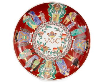
A large Japanese Imari porcelain 'VOC Groningen' dish1800 - 1925
Prix sur demandeZebregs & Röell - Fine Art - Antiques
Artiste Inconnu
Néerlandais en miniature18th century
Prix sur demandeZebregs & Röell - Fine Art - Antiques
1 - 4 / 24- 1 - 4 / 24
- 1 - 4 / 12


