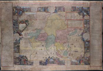
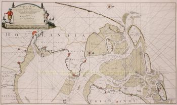
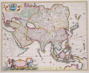
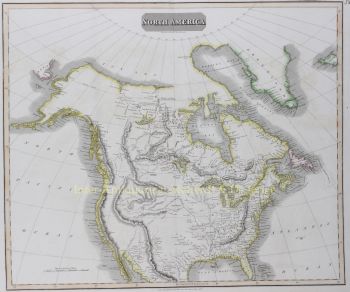
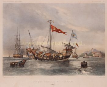
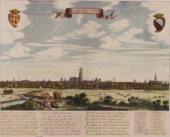
EARLY DUTCH MAP OF ASIA “Asiae Nova Descriptio Auctore Jodoco Hondio.” Copper engraving made in 1628 by Jodocus Hondius for the "Atlas sive cosmographicæ meditationes de fabrica mundi et fabricati figura", here in a third state published in Amsterdam in 1630/31. Original hand-colouring with later additions. Size: 37.5 × 50.2 cm. This richly decorated map of Asia is among the most influential maps of the early seventeenth century. Its image reaches far beyond the continent itself: the map extends across the Pacific Ocean, showing the Philippines, New Guinea, and even part of North America. While the interior of Asia is still largely filled with names and geographical features that hark back to classical and medieval sources such as Strabo, Ptolemy, and Marco Polo, the coastlines reflect the most up-to-date information from late sixteenth-century Dutch cartography. The Indian subcontinent is drawn with remarkable accuracy based on the new sea charts published in Jan Huygen van Linschoten’s Itinerario (1596). In the north, Willem Barentsz’s discoveries around Nova Zembla are included and dated. Japan and Korea are depicted in the form already familiar from Abraham Ortelius’ famous 1584 map of Japan: Japan in a recognizable shape, but Korea as a large island. The southeastern part of the map shows Sumatra, the Malay Peninsula, the Philippines, and the Spice Islands in a reasonably reliable form for the time. New Guinea is accompanied by a Latin note stating that “it is not yet certain whether this is an island or part of a great southern continent.” In the northeast corner of the map appears the mythical "Fretum Anian" (Strait of Anian), which according to the Latin text might be the same as Davis Strait. This supposed connection between Asia and North America was thought by some to be the passage to the Northwest Passage. Hondius relates that attempts to explore the area had been made repeatedly, but always in vain: violent storms, the terrifying roar of the sea, and ice-covered mountains made every effort impossible. The map is not only a major geographical update of Gerard Mercator’s earlier map of Asia, but also an aesthetic masterpiece. Jodocus Hondius enriched it with an elegant strapwork cartouche, decorative rhumb lines, five sea monsters, and four ships that lend the map extra splendour. By combining classical knowledge, the latest discoveries, and a Baroque decorative style, this map stands as one of the most beautiful and influential representations of Asia in the seventeenth century. In the text block at the lower left, Hondius adds a concise description of the origins of the world’s peoples: “In Asia our first parents, Adam and Eve, were created by God. After the Flood, Noah’s Ark came to rest on the mountains of Ararat in Armenia, and from this place the world began anew in the following way: Noah had three sons, Shem, Ham, and Japheth. The descendants of Shem occupied the regions near the Euphrates, eastward. Ham went to the areas near the Jordan and the Nile, further southward. Japheth took Asia Minor, toward the west, and from there many nations spread into Europe (...). From these three lineages the principal nations of the entire world took their origin (...).” Price: 1.450,-


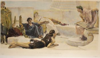
![“Tentation” [temptation], lithograph by Eugène Grasset](https://media-3.gallerease.com/images/b891f1b8-508a-4829-a559-a56b7f765ca7/350x350/tentation-temptation-lithograph.jpg)
