Leone Belgico 1690
Nicolaes Visscher
€ 1.450
Inter-Antiquariaat Mefferdt & De Jonge
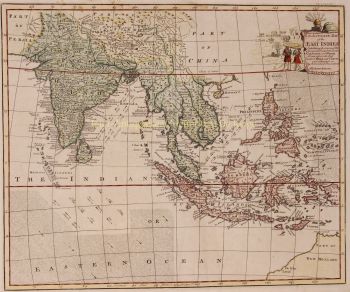
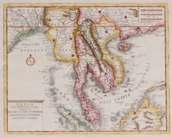
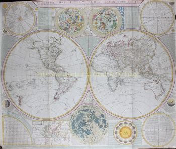
- A proposito di opere d'arteINDIA, SOUTH EAST ASIA, JAPAN AND THE NORTH COAST OF AUSTRALIA "Indiae Orientalis nec non Insularum Adiacentium Nova Descriptio." Copper engraving by Nicolaes Visscher II, published in Amsterdam approx. 1690. Coloured by a later hand. Size (image) 46,3 x 57,5 cm. Beautiful map of South East Asia presenting a detailed image of the sphere of operations and the Asian trading empire of the Dutch East India Company. The map extends from India to the Philippines and the Ladrone Islands, and from southern Japan to Northern Australia (Nova Hollandia). There is a partial outline of Papua New Guinea and considerable cartographic data in the East Indies. It is one of the most accurate early charts of the coastline of north Australia, with many places named along the Gulf of Carpentaria, including Cape Keerweer (where fresh water could be found) on the north coast, reached by Willem Janszoon in the Duyfken in 1606 when sent by the Dutch East India Company to search for new trade opportunities. The decorative title cartouche is surrounded by various people of the region, animals, birds, and a bounty of trade goods. For nearly a century, the Visscher family of cartographers were important mapmakers and mapsellers in Amsterdam. Price: Euro 1.450,-
- A proposito di opere artista
Nicolaes era l'unico figlio di Claes Jansz. Pescatore. È anche conosciuto con i nomi: Nicolaas o Claes Claesz. Dopo anni di lavoro per il padre nell'azienda, gli succedette dopo la sua morte nel 1652. Nel 1662 fu ammesso alla corporazione dei librai di Amsterdam e nel 1677 Nicolaes, ormai rispettato editore, ricevette un brevetto di 15 anni dagli stati dell'Olanda e della Frisia occidentale per la stampa e la pubblicazione di mappe. Morì due anni dopo e fu sepolto nella stessa cappella del padre.
Le edizioni Atlas di Nicolaes I includevano:
"Atlas Contractus Orbis Terrarum" del 1657.
“Germania Inferiore” del 1663.
"Atlante Minore" del 1675.
Gli atlanti di Visscher venivano spesso compilati secondo i desideri degli acquirenti (il cosiddetto Atlas Contractus). Generalmente non contengono testo, solo a volte un indice stampato. Sono state utilizzate carte di altri produttori, lastre di rame autoincise e lavorate da suo padre.Uno dei punti salienti della cartografia seicentesca è la mappa murale a più pagine. Ne è un esempio - del 1656 - la carta della Zelanda: “Zelandiae Comitatus novissima Tabula”. Questo consisteva in nove fogli che insieme avevano una dimensione di 140 x 160 cm. Aggiungendo paesaggi urbani, la mappa potrebbe essere ulteriormente ingrandita. Questi paesaggi urbani furono a loro volta pubblicati intorno al 1668 con il nome: “Speculum Zelandiae”.
Sei interessato ad acquistare questa opera d'arte?
Artwork details
Related artworks
- 1 - 4 / 4
- 1 - 4 / 24
- 1 - 4 / 12


