World Map by Abraham Ortelius
Scroll to zoom, click for slideshow

Wereldkaart 1587

Abraham Ortelius

€ 5.500

Inter-Antiquariaat Mefferdt & De Jonge

  • Over kunstwerk
    ONE OF THE GREAT WORLD MAPS OF ALL TIME "Typus Orbis Terrarum." Copper engraving from Theatrum Orbis Terrarum. Published by Arbraham Ortelius of Antwerp from 1587 onwards. With original (?) hand colouring. Size: 35,5 x 48,5 cm. One of the most famous of world maps, from Ortelius' great work, Theatrum Orbis Terrarum. Initially published in 1570, this volume was the first that could truly be called an ‘atlas’ in the modern sense of a compilation of maps engraved to a uniform format according to the most up-to-date information available. The publication of the Theatrum also marked the inauguration of the era of Dutch supremacy in cartography. For these and other reasons, Abraham Ortelius is called the "father of modern cartography." This particular map is based upon Gerard Mercator's large world map of 1569. Ortelius' atlas project had the blessing and aid of Mercator, who supplied Ortelius with coordinates of places in America. Although the map appears rather erroneous to modern eyes, it actually contains some of the best compilation work of the period, which was a hallmark of mapmaking in the sixteenth century. In the north, islands are shown surrounding the North Pole, and separated from America and Asia by a sea passage, the latter being a popular belief in the sixteenth century. In the south, a large "Terra Australis Nondum Cognita" is drawn, separated from South America by the "Estrecho di Magallanes." “From surviving correspondence it is known that Mercator generously encouraged Ortelius to make use of his published corpus of research; he also provided him with coordinates of places in America and perhaps elsewhere.” – Shirley In 1587 Ortelius updated this seminal map for the third and last time. South America now assumes a more accurate shape, and the Solomon Isles are marked for the first time. The updated map is also distinctive and especially beautiful for the four medallions in the corners with classical texts, two from Cicero and two from Seneca. The border of this map is altered as well, now with a more intricate and elegant lattice of strapwork and swag. Altogether with the embellishments, rich colour and important information, one of the great world maps of all time. Literature: “Ortelius atlas maps”, Marcel van den Broecke, Ort3; “The Mapping of the World”, Rodney Shirley, no. 158, plate 130. Price: Euro 5.500,- (incl. frame)  
  • Over kunstenaar

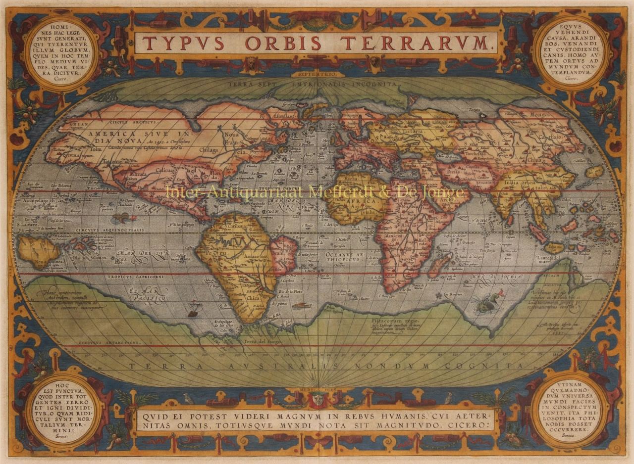
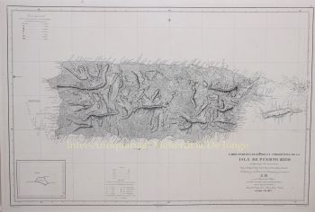
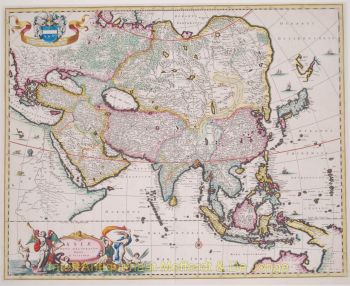
    Abraham Ortelius (1527-1598) was een Vlaamse cartograaf en geograaf die algemeen wordt beschouwd als de maker van de eerste moderne atlas en een van de meest invloedrijke cartografen in de geschiedenis. Zijn baanbrekende publicatie, Theatrum Orbis Terrarum (Theater van de Wereld), betekende een keerpunt in de manier waarop geografische kennis werd verzameld, gestandaardiseerd en gepresenteerd.

    Theatrum Orbis Terrarum, voor het eerst gepubliceerd in 1570, was revolutionair in zowel concept als uitvoering. In tegenstelling tot eerdere kaartencollecties bood Ortelius' atlas een samenhangend en systematisch overzicht van de bekende wereld, met kaarten van uniforme grootte, stijl en kwaliteit, vergezeld van wetenschappelijk commentaar. Deze aanpak transformeerde cartografie van een gefragmenteerd ambacht tot een gestructureerde wetenschappelijke en culturele discipline, waardoor wereldgeografie toegankelijk werd voor wetenschappers, handelaren en staatslieden.

    Ortelius leefde en werkte tijdens de Gouden Eeuw van de Nederlandse cartografie, een periode waarin vooruitgang in ontdekkingsreizen, boekdruk en handel het Europese wereldbeeld hervormde. Samen met Gerardus Mercator wordt Ortelius beschouwd als een van de grondleggers van de Nederlandse cartografie. Terwijl Mercator de kaartprojectie revolutioneerde, blonk Ortelius uit in synthese – het samenbrengen van de beste beschikbare geografische kennis in één gezaghebbend werk.

    Naast zijn technische prestaties was Ortelius een humanistisch denker met een diepe interesse in geschiedenis, de klassieke oudheid en culturele uitwisseling. Hij onderhield een uitgebreid internationaal netwerk van geleerden, ontdekkingsreizigers en cartografen en vermeldde zorgvuldig de bronnen – een ongebruikelijke en vooruitstrevende praktijk voor zijn tijd. Deze wetenschappelijke integriteit droeg aanzienlijk bij aan de geloofwaardigheid en blijvende invloed van zijn werk.

    De nalatenschap van Abraham Ortelius ligt niet alleen in zijn kaarten, maar ook in zijn visie op de wereld als een onderling verbonden geheel. Zijn atlas heeft generaties lang het Europese wereldbeeld gevormd en de basis gelegd voor de moderne cartografie, waarmee hij zijn plaats als een van de grote intellectuele figuren van de Renaissance heeft veiliggesteld.

Bent u geïnteresseerd om dit kunstwerk te kopen?

Artwork details