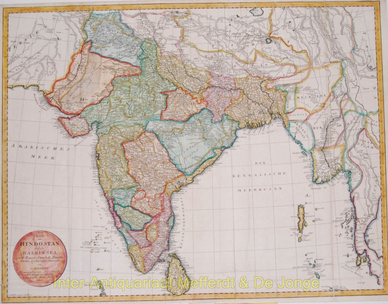
Charte von Hindostan und der Halbinsel nach Rennels, Campbells, Pringles, Diroms Zeichnungen entworfenLarge folding decorative map of the Indian subcontinent. Made by Conrad Mannert, published in Nürnberg by A. G. Schneider u. Weigel, 1804. Original hand colouring with later additions. Size 53,6 x 69,7 cm. Price: Euro350,- (excl. VAT, excl frame)


![European hunting party] by Artista Desconhecido](https://media-2.gallerease.com/images/cb8cbebf-7709-4817-9bdb-fef8ae1e93cf/350x350/european-hunting-party.jpg)