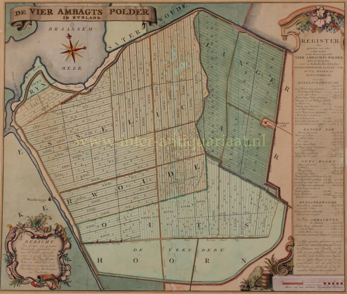
Vierambachtspolder, Woubrugge 1746
Melchior Bolstra
Inter-Antiquariaat Mefferdt & De Jonge
- About the artwork“De Vier Ambagts Polder in Rynland”. Kopergravure naar het ontwerp van Melchior Bolstra, uitgegeven na 1746. In de tijd met de hand gekleurd. Afm. ca. 57,5 x 67,5 cm. De Vierambachtspolder bij Woubrugge en Braassemmermeer, is ontstaan in door het samenvoegen van negen omliggende polders. Deze polders waren verdeeld over vier ambachtsheerlijkheden. In 1732 verzochten de ambachtsbesturen van deze heerlijkheden, Esselijkerwoude, Ter Aar (“Langer Aar” op de kaart), Oudshoorn en Rijnsaterwoude, aan de Staten van Holland om goedkeuring tot de droogmaking en bedijking van het waterschapsgebied Vierambacht. In 1739 is door middel van elf windwatermolens begonnen met het droogmalen van de polder. Een gesloten ringdijk werd om de gehele polder gelegd. In 1744 viel de polder droog. De uiteindelijke verkavelingsrichting werd in 1746 bepaald. Deze is waarschijnlijk gebaseerd op de verkaveling die bestond voor de drooglegging. De vorm van de oude negen polders is nog gedeeltelijk te zien doordat de strokenverkaveling is aangepast aan de oude polderstructuur. Deze grote en zeldzame kaart met “register der grootens van ieder Ambacht” is “gemeeten, gekarteert en gecalculeert” door Melchior Bolstra (1703/4 - 1779), een landmeter die 45 jaar in dienst is geweest van het Hoogheemraadschap van Rijnland. Naast zijn cartografisch werk was hij een ervaren waterbouwkundige die veel nauwkeurige rivier- en meerkaarten gemaakt heeft. Prijs Euro 1.250,- (incl. lijst)
- About the artist
Melchior Bolstra (Makkum, 1703 or 1704 - Leiden, before November 9, 1779) was a Dutch land surveyor, who was employed by the Hoogheemraadschap van Rijnland for 45 years. He also published a very large number of maps of regions outside the Rhineland.
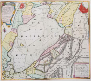
On October 1, 1731, he was appointed surveyor of the Rijnland Water Board. In addition to his cartographic work, he was an experienced hydraulic engineer who made many accurate river and lake maps, such as of the Haarlemmermeer and Leidse Meer. became.
In 1742, the land surveyor Bolstra and the overseers Nicolaus Cruquius and Jan Noppen were commissioned by their employer, the board of the Hoogheemraadschap, to investigate a possible reclamation of the Haarlemmermeer. They recommended the construction of a wide ring canal and drainage by 112 windmills, supplemented by an outlet on the North Sea near Katwijk. The total costs of this proposal would amount to approximately 7 million guilders.
In 1774, they received a follow-up assignment, which was mainly aimed at further combating bank erosion. Ultimately, this lake would only be drained more than a century later, with the help of 3 steam pumping stations.In 1766 he and Frederik Beijerinck were commissioned to do a study of the mouth of the Pannerdens Kanaal. In the years that followed, he made the necessary maps of this area to get an idea of the many shallows. This led to a proposal for deepening works, but these were not carried out because the tenders were too far above the estimates.
In 1772, Bolstra worked with Christiaan Brunings and Jacob Engelman on a study to combat the silting up of the IJ near Amsterdam. This also led to a plan in 1773 that was not implemented because of the high costs.
On November 9, 1776, Klaas Vis was appointed as successor at Rijnland to Bolstra, who had died shortly before that moment.
Are you interested in buying this artwork?
Artwork details
Related artworks
- 1 - 1 / 1
- 1 - 4 / 24
Artista Desconhecido
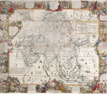
A large wall map of Asia by Nicolas de Fer 1647 - 1720
Preço em pedidoZebregs & Röell - Fine Art - Antiques
Cornelis Anthonisz Theunissen
MUITO RARO PRIMEIRO MAPA IMPRESSO DE AMESTERDÃO, UMA CIDADE EM ASCENSÃO1544
€ 175.000Inter-Antiquariaat Mefferdt & De Jonge
 Com curadoria de
Danny Bree
1 - 4 / 17- 1 - 4 / 24
- 1 - 4 / 12

