World map  by Melchior Tavernier
Scroll to zoom, click for slideshow

Mapa mundial 1636

Melchior Tavernier

€ 9.500

Inter-Antiquariaat Mefferdt & De Jonge

  • Sobre arte
    RARE AND STRIKINGLY BEAUTIFUL WORLD MAP “Nova Totius Terrarum Orbis Geographica ac Hydrographica Tabula auct. Iud. Hondio.” Copper-engraved map from the “Théâtre Géographique Du Royaume de France…” published in Paris by Melchior Tavernier, here in its second state of 1636. Coloured by a later hand. Size: 39,0 x 57,5 cm (plus margins). This double hemisphere map is based on Jodocus Hondius' world map of 1617 or possibly Jacob Honervogt's map of 1625, who also followed Jodocus Hondius’map. The ecliptic curves on Tavernier's map are reversed so that the line is north of the equator in the western hemisphere and east of south of the equator in the eastern hemisphere. The map by Hondius was the first to show Le Maire's Straits and the islands in the Pacific discovered by Jacob Le Maire and his explorations in New Guinea. In North America, Hondius' map was also one of the earliest to delineate Hudson's Bay, making special reference to Henry Hudson and the Dutch and English expeditions there up to 1612. Hondius also extends the full course of the St. Lawrence river which now curiously runs across the continent, terminating in a large lake. Decoratively, the map is one of the most attractive. The corners contain scenes of the four seasons. Ver or Spring, shows gardeners tending a formal Dutch garden; Aestas or Summer is the time for sheep-shearing; Autumn brings the grape harvest in for wine-pressing; and in Hyems or Winter skaters revel on a frozen lake. On either side of north and south celestial hemispheres are recumbent figures representing the four elements: Terra, Aqua, Ignis and Aer. The map in the cartouche on the right, is dedicated to the English mathematicians Henry Briggs and Edward Wright. Literature: The Mapping of the World, Rodney Shirley no. 337, plate 230. Price: Euro 9.500,- (incl. frame)
  • Sobre artista

    Melchior Tavernier I (1564 - 1641) foi um gravador francês de ascendência flamenga. Nascido em Antuérpia, era filho de Gabriel Tavernier e pai de Melchior Tavernier II (1584 – 1665). Ele pode ter estudado com Ortelius em Antuérpia.

    Seu pai, Gabriel Tavernier, é creditado por introduzir a prensa de rolos em Paris. Ele teve a distinção de ser Imprimeur en Tailles-douces de la Maison de Sa Majesté. A oficina de Tavernier estava localizada perto de Pont Marchand, onde aparentemente vários outros impressores, incluindo Gobert e Collet, também mantinham negócios.

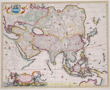
    Melchior Tavernier é irmão do célebre escritor e viajante Jean-Baptiste Tavernier (1605-1689). Tavernier gravou vários mapas importantes para figuras como Samuel de Champlain e outros. A obra de Melchior Tavernier II é difícil de distinguir da de seu filho, Melchior Tavernier II.

Você está interessado em comprar esta obra de arte?

Artwork details