Achterhoek (County of Zutphen)  by Johannes Janssonius
Scroll to zoom, click for slideshow

Achterhoek (comté de Zutphen) 1641

Johannes Janssonius

€ 295

Inter-Antiquariaat Mefferdt & De Jonge

  • Sur l'oeuvre d'art

    THE QUARTER OF ZUTPHEN "Comitatus Zutphania", copper engraving published by Johannes Janssonius in 1641 as part of his "Nouveau Theatre du Monde ou Nouvel Atlas". Coloured by hand at the time. Measures 46.5 x 56.4 cm. In the years 1557 to 1559 the area was mapped by Christiaan sGrooten. sGrooten's map of Gelderland was also the model for Janssonius' map of the County of Zutphen. We see the Kleef area near Huissen and Zevenaar clearly delimited. Isselburg falls within the border of the County. There are no siege works drawn around Groenlo. The area of the manor of Borculo fell under the Earldom after 1615, but is shown here as part of the Bishopric of Münster. For the city of Zutphen, the Eighty Years' War brought difficult times. In 1572, Zutphen was captured by William of Orange's brother-in-law. The Spaniards were driven out, but half a year later they took the city back and executed hundreds of inhabitants. In 1577, the Spaniards left the city, but the Catholic city council remained in place. In the summer of 1579, the Protestants seized power and deposed the Roman Catholic administrators. In 1583, Zutphen was again in the hands of the Spaniards but after that, the city was besieged two more times by the Staatsen. In 1591, Prince Maurits conquered Zutphen until, in 1629, a German-Spanish army once again invaded the Veluwe and went on a killing spree. Top right, the city arms of Zutphen are depicted, with the Count's Crown on top. Bottom right the scale of the map is flanked by winged angels with claws, on top is an armillary as a symbol of wisdom and knowledge (of the mapmaker). Price: Euro 295,-

  • Sur l'artiste

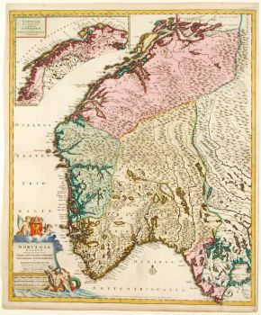
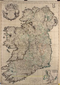
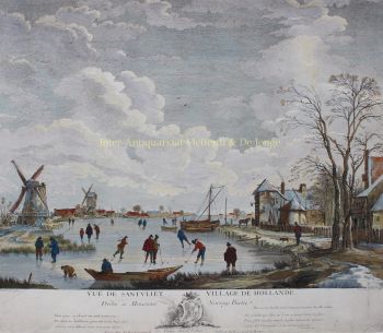
    Janssonius est né à Arnhem en tant que fils de Jan Jansz, imprimeur et éditeur là-bas. Très jeune, il s'installe à Amsterdam, alors centre de l'imprimerie et du commerce de cartes. En 1612, il épousa Elisabeth Hondius, fille de Jodocus Hondius. Elisabeth mourut en 1627 et Janssonius se remaria en 1629 avec Elisabeth Carlier. Il est allé travailler pour son beau-père et a continué l'entreprise d'édition avec Henricus Hondius (fils de) après sa mort. Cela a été développé dans l'un des plus grands de son temps. Il y avait des succursales à Berlin, Francfort, Genève, Lyon et Stockholm, entre autres.

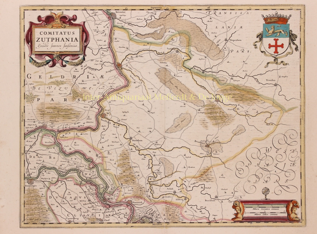
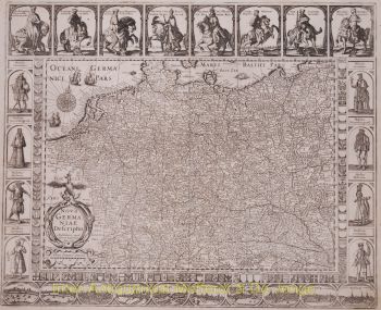
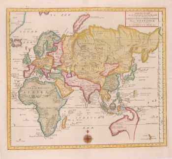
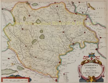
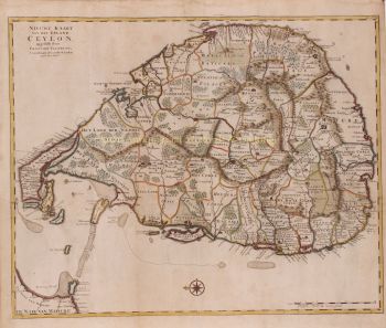
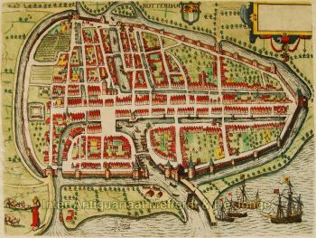
    Sous la direction de Janssonius, l'Atlas Mercator-Hondius a été élargi et publié sous le nom d'Atlas Novus. Cette édition initialement en un volume est rapidement devenue un atlas en plusieurs volumes, complété sur demande par des cartes marines et/ou des cartes célestes. Il y avait des publications en néerlandais, français, espagnol et latin. Tout comme ses contemporains, Janssonius a également utilisé des plaques de cuivre existantes, notamment celles des livres de ville de Braun & Hogenberg et la Description de touts les Pays Bas (Description de tous les Pays-Bas) de Lodovico Guicciardini - (édition Cornelis Claesz.) de 1609 Bien que Janssonius ait souvent été accusé de copier l'œuvre de Willem Blaeu, on peut noter que des cartes de Janssonius sont également apparues sur le marché plus tôt.

    Après la mort de Janssonius, l'entreprise a été poursuivie par son gendre, Johannes (Jan) van Waesbergen, qui était marié à sa fille Elisabeth Janssonius (1615-1681). De nombreuses plaques de cuivre des livres de la ville ont été utilisées (parfois légèrement modifiées) par Frederik de Wit. Le bâtiment de la place du Dam a été loué à Gérard Valck ; Il a également acheté un certain nombre de plaques d'impression en 1694.

Êtes-vous intéressé par l'achat de cette oeuvre?

Artwork details