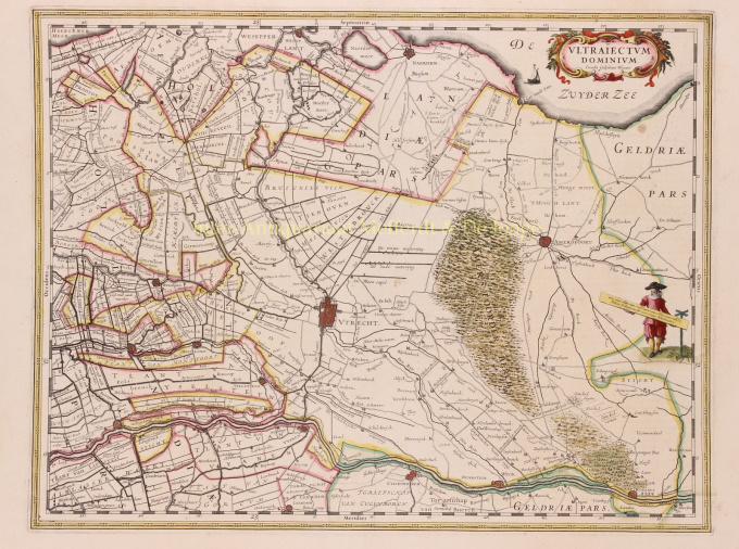
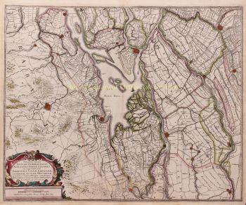
Utrecht / Gooi 1635
Willem Janszoon Blaeu
€ 650
Inter-Antiquariaat Mefferdt & De Jonge
- Sur l'oeuvre d'art
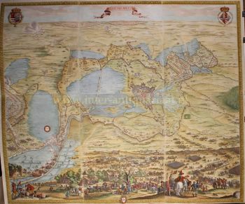
THE HOLIDAY OF UTRECHT "Ultrajectum Dominium". Copper engraving published in 1635 by Willem Blaeu. Verso: French text. Coloured by hand. Sizes 38 x 49,5 cm. Willem Blaeu made this map based on one by Balthasar Florisz. van Berckenrode from 1620. There were no country houses on the Vecht or in 's-Graveland at that time. Monasteries on the Vecht are still depicted, but by then they had already fallen into ruin. This was the time when canals were dug between towns and existing waterways were made suitable for towing ships. In 1599, a towpath was constructed along the Amstel River from Amsterdam to Uithoorn, and between 1626 and 1628 parts of the Amsterdam-Utrecht section were constructed. The first towpaths were constructed as connections between two cities, but in the course of the 17th century more and more separate towpaths were linked. This is how large canal networks came into being. From 1588 (until the French era), the Utrecht District was one of the provinces of the Republic of the Seven United Provinces. What the map does not tell you is that when it appeared, a plague epidemic was raging in Utrecht, which would not stop until 1638. As much as 15 percent of Utrecht's population would die as a result of this disease. Blaeu was inspired to make an atlas like no other in the world. Financial reasons were secondary; the risk was too great for that. But there was rivalry between the publishers of Blaeu and Janssonius and motives such as prestige and display were at least as important. He wanted to create something that would overwhelm the civilised world in the heyday of Amsterdam's power. Out of this ambition appeared the "Atlas Maior". Price: Euro 650,-
- Sur l'artiste
"Willem Janszoon Blaeu et son fils Joan ont incarné "l'âge d'or" de la cartographie néerlandaise. Travaillant au XVIIe siècle, Willem Blaeu a dessiné un certain nombre de cartes révolutionnaires et publié le premier atlas.
Il est né en 1571 à Amsterdam et a d'abord travaillé comme commis dans le commerce familial du hareng. Cependant, il n'était pas satisfait de son occupation et quitta la maison en 1594 pour étudier les mathématiques avec Tycho Brahe, le célèbre astronome. Blaeu était un bon élève qui impressionnait beaucoup son tuteur, et quand ses études furent terminées, il retourna à Amsterdam et s'installa comme cartographe. Son entreprise a prospéré et sa réputation a grandi. Il a été le premier cartographe à produire des cartes à feuille unique de nombreux pays européens.
En 1605, il a fait une carte murale du monde, englobant 20 feuilles, chacune de 8 pieds de diamètre. Cette carte était de loin la plus précise de l'époque et apporta une contribution remarquable à la connaissance de la géographie mondiale.
Sa carte est restée la plus précise jusqu'en 1648, lorsque son fils, Joan, qui est également devenu un célèbre cartographe, l'a mise à jour. Mais sa plus grande réalisation fut la production du premier atlas en 1630. Le nom Blaeu était en fait un surnom de famille que Willem prit après une confusion entre lui et son grand rival Joannes Jansonius.
Êtes-vous intéressé par l'achat de cette oeuvre?
Artwork details
Related artworks
- 1 - 4 / 8
- 1 - 4 / 24
- 1 - 4 / 12

