Seventeen Provinces  by Willem Janszoon Blaeu
Scroll to zoom, click for slideshow

Seventeen Provinces 1635

Willem Janszoon Blaeu

TintaPapelImprimir
40 ⨯ 50 cm
€ 1.450

Inter-Antiquariaat Mefferdt & De Jonge

  • Sobre arte
    FAMOUS MAP OF THE SEVENTEEN PROVINCES “Novus XVII Inferioris Germaniæ Provinciarvm Typvs de integro multis in locis emendatus à Guliel. Blaeu.” Copper enrgaving made by Josua vanden Ende, here in its 3rd state published by Willem Bleau in 1635. Verso: French text. With original hand colouring. Size: 40 x 50,5 cm. The bottom right shows a cartouche with scale bar and the address of Willem Blaeu: "op 't Water in de Vergulde Zonnewyzer" [current day Damrak in Amsterdam]. On the left a cartouche a list of towns and villages per province and a legend of the symbols used. In the North Sea we see a 32-piece compass rose, a sea monster and many ships. The Fall of Antwerp in 1585 caused a de facto separation between the Northern and Southern Netherlands and the seventeen provinces split into two parts. A border arose whereby the Seventeen Provinces were split into the Republic of the Seven United Netherlands and the Southern Netherlands. Because of emigration and a change in the political situation, the economic center of The Netherlands shifted to the north. The Dutch Revolt against the Spaniards continued and meanwhile religion divided the entire continent into two parts. All of Europe was now at war, and conflicts were not resolved until the Peace of Münster in 1648. In the treaty Dutch Republic was recognized by Spain as sovereign state. At that time, the separation of the northern and southern Netherlands was a fact. Nevertheless, maps of the Seventeen Provinces regularly occur up to about 1800. This was partly beacause of the enormous costs for the fieldwork and engraving that came with the production of new maps, but was also due to the unclear borders of the area in the east and south of the Dutch Republic. Reference: H.A.M. van der Heijden “Oude kaarten der Nederlanden, 1548-1794", map 64.3 Price: Euro 1.450,-
  • Sobre artista

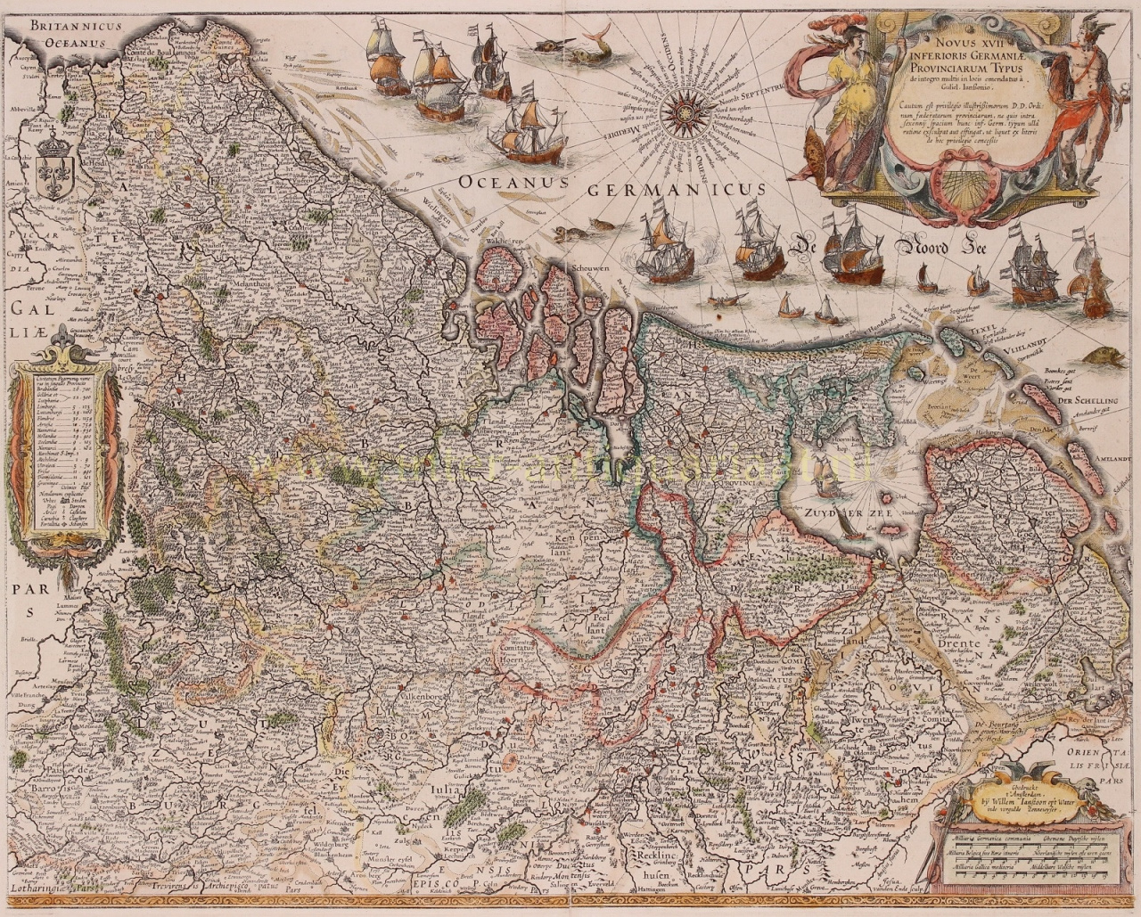
    "Willem Janszoon Blaeu e seu filho Joan resumiram a 'era de ouro' da cartografia holandesa. Trabalhando durante o século XVII, Willem Blaeu desenhou uma série de mapas inovadores e publicou o primeiro atlas.

    Ele nasceu em 1571 em Amsterdã e trabalhou inicialmente como balconista no comércio de arenque da família. No entanto, ele não estava feliz com sua ocupação e saiu de casa em 1594 para estudar matemática com Tycho Brahe, o famoso astrônomo. Blaeu era um bom aluno que impressionou muito seu tutor e, quando seus estudos terminaram, ele voltou para Amsterdã e abriu um negócio como cartógrafo. Seu negócio floresceu e sua reputação cresceu. Ele foi o primeiro cartógrafo a produzir mapas de folha única de muitos países europeus.

    Em 1605, ele fez um mapa-múndi de parede, contendo 20 folhas, cada uma com 2,5 metros de largura. Este mapa foi de longe o mais preciso do período e deu uma contribuição notável para o conhecimento da geografia mundial.

    Seu mapa permaneceu o mais preciso até 1648, quando seu filho, Joan, que também se tornou um famoso cartógrafo, o atualizou. Mas sua maior conquista foi a produção do primeiro atlas em 1630. O nome Blaeu era na verdade um apelido de família que Willem adotou depois que ocorreu uma confusão entre ele e seu grande rival Joannes Jansonius.

Você está interessado em comprar esta obra de arte?

Artwork details