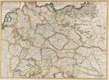
Antica mappa della Germania 1626
Johannes Janssonius
€ 5.500
Inter-Antiquariaat Mefferdt & De Jonge
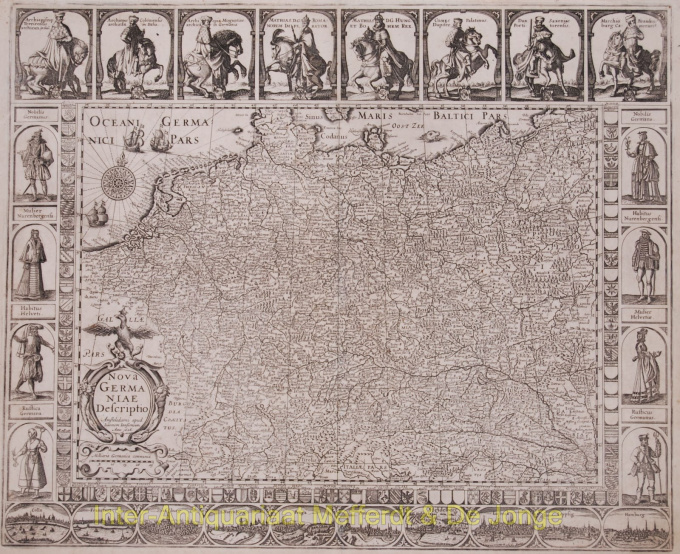
- A proposito di opere d'arteAntique Germany map - Nova Germaniae Descriptio Beautiful map of greater Germany. 2nd state (out of 5) published in 1626 by Johannes Janssonius, originally published by Petrus Kaerius in 1615. Size: 47 x 57,2 cm. The map is framed on all sides with decorative borders. The top border contains portaits of Emperor Matthias with the seven Electors, all on horseback. Matthias is shown twice: as emperor and as king of Bohemia and Hungary. On three sides the map image is framed by shields with coats of arms. Along the bottom border runs a strip with ten town views in oval frames: Cologne, Frankfurt, Strassbourg, Nurenberg, Prague, Augsburg, Hedeilberg, Lübeck and Hamburg. Willem janszn.'s map of 1609 served as a model for the town views. The coats of arms along the side borders are flanked by costumed figures. Verso: blank. Literature: Günther Schilder, Monumenta Cartographica VI, 33.2 Price: Euro5.500,- (excl. VAT/BTW)
- A proposito di opere artista
Janssonius è nato ad Arnhem come figlio di Jan Jansz, tipografo ed editore locale. In giovane età si trasferì ad Amsterdam, l'allora centro della stampa e del commercio di carte. Nel 1612 sposò Elisabeth Hondius, figlia di Jodocus Hondius. Elisabeth morì nel 1627 e Janssonius si risposò nel 1629 con Elisabeth Carlier. Andò a lavorare per suo suocero e continuò l'attività editoriale insieme a Henricus Hondius (figlio di) dopo la sua morte. Questo è stato sviluppato in uno dei più grandi del suo tempo. C'erano filiali a Berlino, Francoforte, Ginevra, Lione e Stoccolma, tra gli altri.
Sotto la guida di Janssonius, il Mercator-Hondius Atlas fu ampliato e pubblicato come Atlas Novus. Questa edizione inizialmente monovolume si trasformò ben presto in un atlante in più volumi, integrato su richiesta con carte nautiche e/o carte celesti. C'erano pubblicazioni in olandese, francese, spagnolo e latino. Come i suoi contemporanei, anche Janssonius fece uso di lastre di rame esistenti, tra cui quelle dei libri cittadini di Braun & Hogenberg e la Description de touts les Pays Bas (Descrizione di tutti i Paesi Bassi) di Lodovico Guicciardini - (edizione Cornelis Claesz.) da 1609 Sebbene Janssonius sia stato spesso accusato di aver copiato il lavoro di Willem Blaeu, si può notare che anche le mappe di Janssonius sono apparse sul mercato prima.
Dopo la morte di Janssonius, l'azienda fu portata avanti da suo genero, Johannes (Jan) van Waesbergen, che sposò sua figlia Elisabeth Janssonius (1615-1681). Molte lastre di rame dei libri cittadini furono utilizzate (a volte leggermente modificate) da Frederik de Wit. L'edificio in piazza Dam è stato affittato a Gerard Valck; Ha anche acquistato una serie di lastre da stampa nel 1694.
Sei interessato ad acquistare questa opera d'arte?
Artwork details
Related artworks
- 1 - 4 / 4
- 1 - 4 / 24
- 1 - 4 / 12

