The city of Delft in 1649 by Joan Blaeu
Scroll to zoom, click for slideshow

The city of Delft in 1649 1649

Joan Blaeu

InchiostroCartaStampa
48 ⨯ 57 cm
€ 1.850

Inter-Antiquariaat Mefferdt & De Jonge

  • A proposito di opere d'arte
    THE CITY OF DELFT "Delfi Batavorum vernacule Delft", copper engraving, published in Amsterdam by Joan Blaeu in 1649. Size (print) 37,7 x 48,5 cm. Coloured by a later hand. Verso: Latin description of Delft. Until the 17th century, Delft was one of the major cities of Holland. Already in 1400, the city had 6500 inhabitants and was the third largest in size, after Dordrecht (8000) and Haarlem (7000). In 1560 Amsterdam with 28,000 inhabitants had become the largest city, followed by Delft, Leiden and Haarlem, each of which had about 14,000 inhabitants. In the 17th century, Delft experienced a new heyday. A Chamber of the VOC was established in Delft. The city sent a fleet to Southeast Asia three times a year, importing spices, Chinese porcelain and other luxury goods. The tradition of Delftware originated from the import of Chinese porcelain, with an extensive pottery industry. During the Eighty Years' War, Delft became a center of resistance against the Spanish, after several cities and territories managed to evade Spanish authority in the 1570s. Prince William of Orange briefly resided in Delft, in the former Sint-Agatha monastery, which has since been called Prinsenhof. After William of Orange was declared an outlaw by King Philip II, he was also murdered there by Balthasar Gerards in 1584. William of Orange is buried in the Nieuwe Kerk, clearly visible on the map on the market square. After William of Orange, 45 members of the House of Orange and the House of Orange-Nassau were buried in the royal crypt. This map was published after the Peace of Münster (1648) as part of Joan Blaeu's town book of the Netherlands "Novum Ac Magnum Theatrum Urbium Belgicae Liberae Ac Foederatae". The Amsterdam cartographer and publisher Joan Blaeu set himself the task of simultaneously achieving the objectives of Abraham Ortelius (famous for the publication of the first modern atlas in 1578) and Georg Braun and Franz Hogenberg (known for their town book published at the end of 1600): a multi-volume world atlas added by a number of town books. The town book of the United Netherlands was published in a Latin edition in 1649; the Dutch edition was printed in 1652. Some of the maps included in this work had already been published in older maps, other maps were made entirely new for Blaeu's town book. Price: Euro 1.850,-
  • A proposito di opere artista

    Joan Blaeu (1596-1673), nacque il 23 settembre 1596 ad Alkmaar.

    Era un cartografo olandese nato ad Alkmaar. Ha seguito le orme di suo padre, il cartografo Willem Blaeu.

    Nel 1620 divenne dottore in legge ma si unì al lavoro del padre. Nel 1635 pubblicarono l'Atlas Novus (titolo completo: Theatrum orbis terrarum, sive, Atlas novus) in due volumi. Joan e suo fratello Cornelius rilevarono lo studio dopo la morte del padre nel 1638. Joan divenne il cartografo ufficiale della Compagnia Olandese delle Indie Orientali.

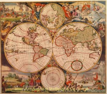
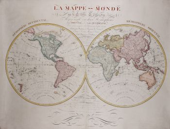
    La mappa del mondo di Blaeu, Nova et Accuratissima Terrarum Orbis Tabula, che incorpora le scoperte di Abel Tasman, fu pubblicata nel 1648. Questa mappa era rivoluzionaria in quanto "raffigura il sistema solare secondo le teorie eliocentriche di Niccolò Copernico, che mostrano la terra che ruota attorno il sole... Sebbene l'innovativo libro di Copernico Sulle rivoluzioni delle sfere fosse stato stampato per la prima volta nel 1543, poco più di un secolo prima, Blaeu fu il primo cartografo a incorporare questa rivoluzionaria teoria eliocentrica in una mappa del mondo."

    La mappa di Blaeu è stata copiata per la mappa del mondo ambientata nel pavimento del Groote Burger-Zaal del nuovo municipio di Amsterdam, progettato dall'architetto olandese Jacob van Campen (ora il Palazzo Reale di Amsterdam), nel 1655.

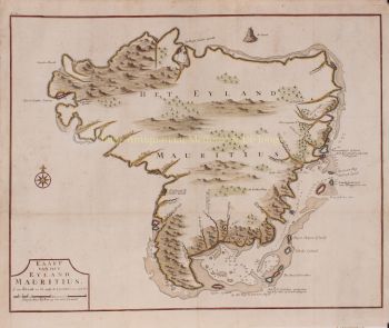
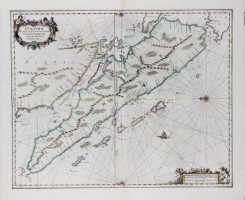
    L'Hollandia Nova di Blaeu fu raffigurata anche nel suo Archipelagus Orientalis sive Asiaticus pubblicato nel 1659 nel Kurfürsten Atlas (Atlante del Grande Elettore). e utilizzato da Melchisédech Thévenot per produrre la sua mappa, Hollandia Nova-Terre Australe (1664).

    Come "Jean Blaeu", ha anche pubblicato il volume 12 "Le Grand Atlas, ou Cosmographie blaviane, en laquelle est exactement descritto la terre, la mer, et le ciel". Un'edizione è datata 1663. Era in folio (540 x 340 mm) e conteneva 593 mappe e tavole incise. Nel marzo 2015, una copia era in vendita per £ 750.000.

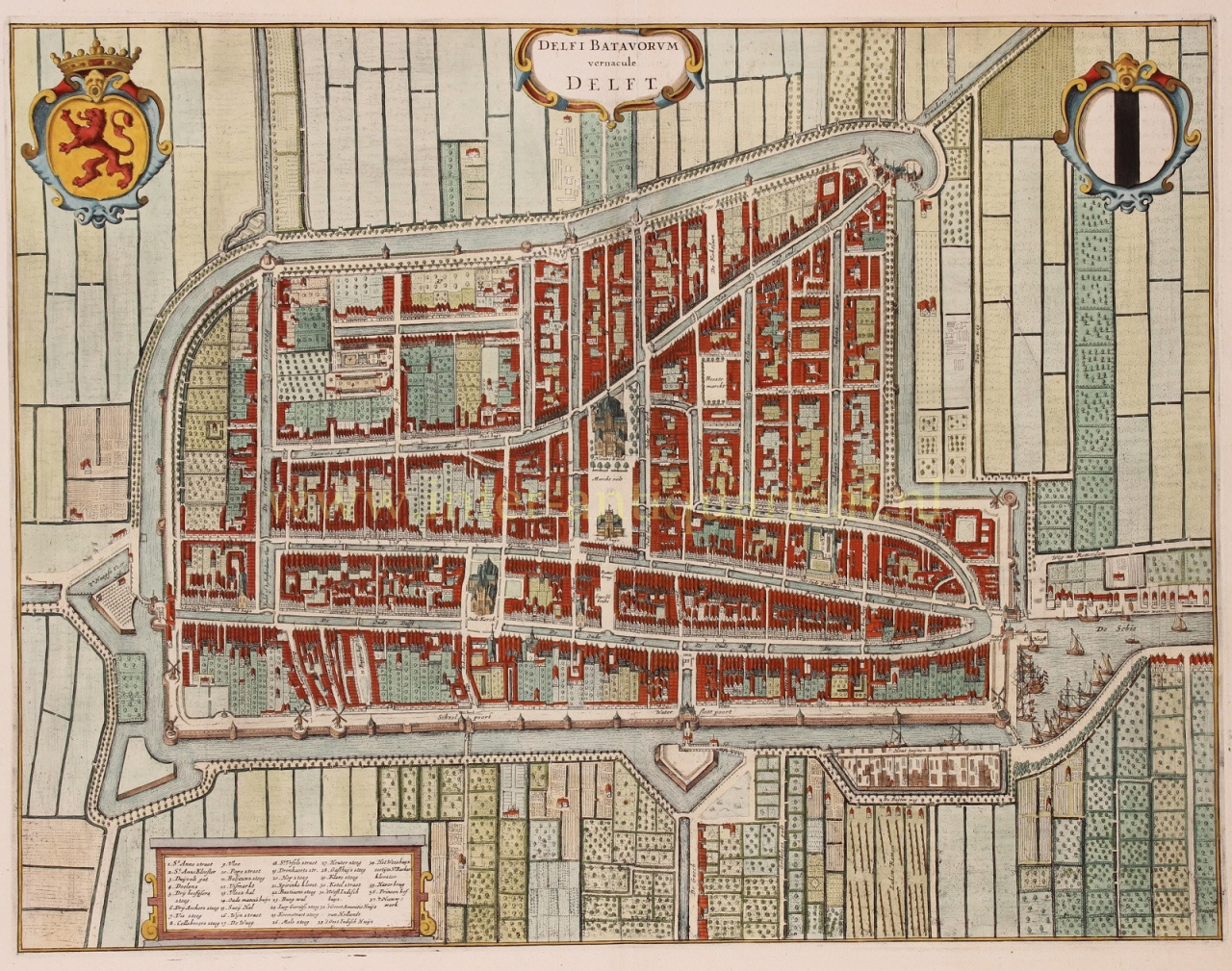
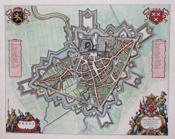
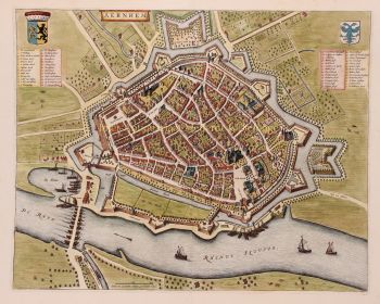
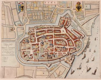
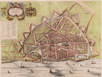
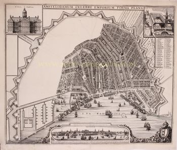
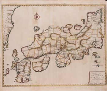
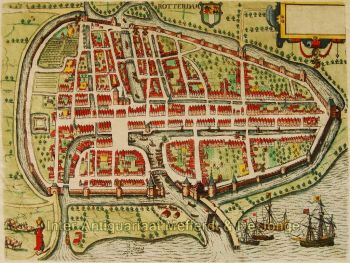
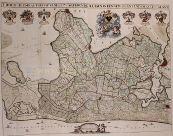
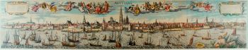
    Intorno al 1649 Joan Blaeu pubblicò una raccolta di mappe cittadine olandesi chiamata Toonneel der Steeden (Vedute di città). Nel 1651 fu votato nel consiglio di Amsterdam. Nel 1654 Joan pubblicò il primo atlante della Scozia, ideato da Timothy Pont. Nel 1662 ristampò l'Atlas Novus, noto anche come Atlas Maior, in 11 volumi e uno per gli oceani.

    Una cosmologia era prevista come progetto successivo, ma un incendio distrusse completamente lo studio nel 1672.

    Joan Blaeu morì ad Amsterdam l'anno successivo, 1673. Fu sepolto nella Westerkerk ad Amsterdam.

Sei interessato ad acquistare questa opera d'arte?

Artwork details