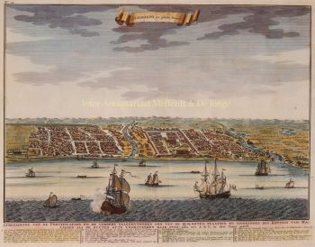
South East Asia 1690
Nicolaes Visscher
€ 1.450
Inter-Antiquariaat Mefferdt & De Jonge
- About the artworkINDIA, SOUTH EAST ASIA, JAPAN AND THE NORTH COAST OF AUSTRALIA "Indiae Orientalis nec non Insularum Adiacentium Nova Descriptio." Copper engraving by Nicolaes Visscher II, published in Amsterdam approx. 1690. Coloured by a later hand. Size (image) 46,3 x 57,5 cm. Beautiful map of South East Asia presenting a detailed image of the sphere of operations and the Asian trading empire of the Dutch East India Company. The map extends from India to the Philippines and the Ladrone Islands, and from southern Japan to Northern Australia (Nova Hollandia). There is a partial outline of Papua New Guinea and considerable cartographic data in the East Indies. It is one of the most accurate early charts of the coastline of north Australia, with many places named along the Gulf of Carpentaria, including Cape Keerweer (where fresh water could be found) on the north coast, reached by Willem Janszoon in the Duyfken in 1606 when sent by the Dutch East India Company to search for new trade opportunities. The decorative title cartouche is surrounded by various people of the region, animals, birds, and a bounty of trade goods. For nearly a century, the Visscher family of cartographers were important mapmakers and mapsellers in Amsterdam. Price: Euro 1.450,-
- About the artist
Nicolaes was the only son of Claes Jansz. Fisher. He is also known by the names: Nicolaas or Claes Claesz. After years of working for his father in the business, he succeeded him after his death in 1652. In 1662 he was admitted to the Amsterdam booksellers' guild and in 1677 Nicolaes, by now a respected publisher, received a 15-year patent from the states of Holland and West Friesland for the printing and publishing of maps. He died two years later and was buried in the same chapel as his father.
Atlas editions of Nicolaes I included:
"Atlas Contractus Orbis Terrarum" from 1657.
“Germania Inferior” from 1663.
“Atlas Minor” from 1675.
Visscher's atlases were often compiled according to the wishes of the buyers (the so-called Atlas Contractus). They generally contain no text, only sometimes a printed index. Cards from other makers were used, self-engraved and worked copper plates from his father.One of the highlights of seventeenth-century cartography is the multi-page wall map. An example of this - from 1656 - is the map of Zeeland: “Zelandiae Comitatus novissima Tabula”. This consisted of nine sheets that together had a size of 140 x 160 cm. By adding cityscapes, the map could be enlarged even further. These cityscapes were in turn published around 1668 under the name: “Speculum Zelandiae”.
Are you interested in buying this artwork?
Artwork details
Related artworks
- 1 - 4 / 4
- 1 - 4 / 24
- 1 - 4 / 12


