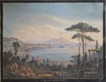
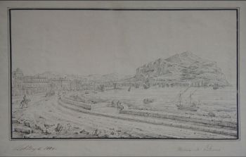
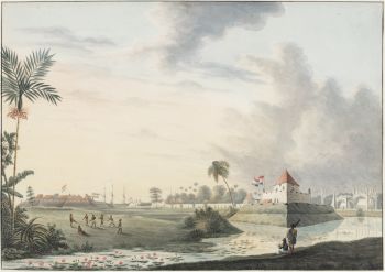
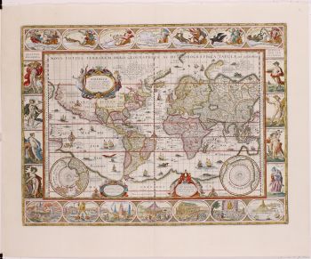
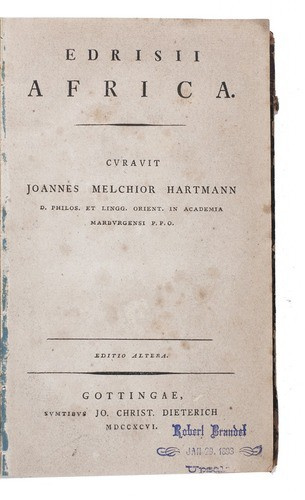
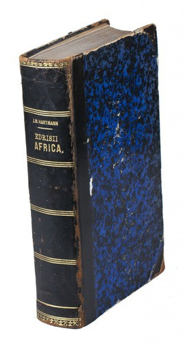
Al-Idrisi's geographical account of northern Africa 1796
Muhammad Idrisi
PapelCouro
Atualmente indisponível via Gallerease
- Sobre arteAL-IDRISI, Muhammad and Joannes Melchior HARTMANN (translator).
Africa.
Göttingen, Johann Christian Dieterich, 1796. 8vo.
Slightly later black half goatskin.
Second edition of a Latin translation of a work on the geography of Africa, written by the Islamic geographer and botanist Muhammad al-Idrisi (1100-1165). It deals specifically with the geography of northern Africa, Egypt and the Sahara desert, covering its soil, cities, population, mountains, deserts, rivers and monuments. Al-Idrisi also mentions various travel routes from one city to the other. Around 1138, al-Idrisi was invited to the court of the king of Sicily, Roger II, who asked him to map the world as it was then known. This map is now lost, but Roger II also asked for supplemental texts to comment on the map. "Emissaries were sent far and wide, and from the information they brought back the Kitab al-Rojari [Book of Roger] was compiled, and completed by January 1154" (Howgego). Various manuscripts containing (parts of the) Kitab al-Rojari have survived, and the present translation was based on one of them. The present work was translated and edited by the Johannes Melchior Hartmann (1764-1817), who worked from a medieval Arabic manuscript at the University of Jena.
With a library stamp. Somewhat browned and foxed throughout. Binding worn at hinges and along the extremities. Otherwise in good condition.
Gay 345; Howgego, to 1800, I5; not in Atabey; Blackmer. - Sobre artistaMuhammas al-Idrisi (nascido em 1100, Sabtah, Mor. - morreu em 1165/66, Sicília ou Sabtah), foi um famoso geógrafo árabe e conselheiro de Roger II, o rei normando da Sicília. Poucos fatos são conhecidos sobre a vida de al-Idrīsī. Ele nasceu em Sabtah (hoje Ceuta, um enclave espanhol no Marrocos), passou grande parte de sua juventude viajando pelo Norte da África e Espanha e parece ter adquirido informações detalhadas e precisas sobre as duas regiões. Ele é conhecido por ter estudado em Córdoba por alguns anos. Ele viajou para muitas partes da Europa Ocidental, incluindo Portugal, norte da Espanha, costa atlântica francesa e sul da Inglaterra. Ele visitou a Ásia Menor quando tinha 16 anos. Por volta de 1145, al-Idrīsī entrou ao serviço de Rogério II da Sicília, uma etapa que marcou uma virada em sua carreira. Roger II o encarregou de fazer um mapa do mundo, resultando na conclusão de três grandes trabalhos geográficos: um planisfério prateado no qual estava representado um mapa-múndi, um mapa-múndi dividindo a Terra ao norte do Equador em 7 zonas climáticas e um texto geográfico como uma chave para o planisfério. Esta foi sua magnum opus de geografia descritiva, conhecida como Al-Kitāb ar-Rujārī (“O Livro de Roger”). Al-Idrīsī concluiu o livro em janeiro de 1154, pouco antes da morte de Roger. O planisfério prateado foi perdido, mas os mapas e o livro sobreviveram. Al-Idrīsī tinha um bom conhecimento da literatura árabe e também era um poeta talentoso. Os últimos anos de sua vida são desconhecidos. Seu nome completo era Abu Abdullah Muhammad al-Idrisi al-Qurtubi al-Hasani as-Sabti (أبو عبد الله محمد الإدريسي القرطبي الحسني السبتي)
Artwork details
Related artworks
Tilmanus Nicolaus Maastricht
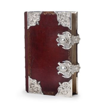
Missale Romanum com montagens de prata holandesa1788 - 1792
Preço em pedidoJacob J. Roosjen SRI
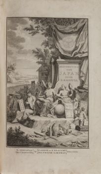
Engelbert Kaempfer
LIVRO ENGELBERT KAEMPFER1651 - 1716
Preço em pedidoZebregs & Röell - Fine Art - Antiques
LAWRENCE WEINER
"SKIMMING THE WATER [MENAGE A QUATRE]" Signed book plus small artwork2010 - 2014
Preço em pedidoGallerease Selected
Engelbert Kaempfer
LIVRO ENGELBERT KAEMPFER1651 - 1716
Preço em pedidoZebregs & Röell - Fine Art - Antiques
Yoko Ono
YOKO ONO: "ARISING" SIGNED BOOK PLUS SMALL ARTWORK 2010 - 2014
Preço em pedidoGallerease Selected
1 - 4 / 22- 1 - 4 / 10
Adrianus Johannes Groenewegen
Schaapsherder met kudde1874 - 1963
Preço em pedidoGalerie Het Noorderlicht
1 - 4 / 24