British Isles - Willem Blaeu, c. 1645 1645
Willem Janszoon Blaeu
ImprimirGravação
41 ⨯ 52 cm
€ 1.650
Inter-Antiquariaat Mefferdt & De Jonge
- Sobre arteBLAEU’S HEPTARCHY MAP “Britannia prout divisa fuit temporibus Anglo-Saxonum praesertim durante illorum Heptarchia.” Copper engraving published by Willem Blaeu in Amsterdam c. 1645. Verso text in Latin. With original hand colouring. Size: 41,2 x 52,6 cm. Wonderful map of Anglo-Saxon England flanked by intricately rendered portraits of the kings of the 5th through 7th centuries. The monarchs to the left are those of the pre-Christian era, while those on the right are depicted receiving Christianity or being martyred for its sake. Sebert of Essex can be seen in the second panel down on the right re-consecrating the temples of Apollo and Diane; they would become St. Paul’s Cathedral in London, and St. Peter’s at Westminster. This is often called the Heptarchy Map, as it presents England during the time following the Anglo Saxon conquest of southern England, approximately from 500 to 850 A.D., which is known as the Heptarchy Period. (The word itself refers to the seven kingdoms that would eventually combine to form the Kingdom of England in the 10th century.) The map shows England divided into the seven Saxon kingdoms, each decorated with its coat-of-arms. Scotland, Wales, and part of Ireland are also shown with their arms. The kings are shown with their escutcheons and their forces (townships) named. The vignettes flanking the two sides are identical in subject matter to those used in 1626 on a map by John Speed, but the execution of each is in the style of "an unmistakeable Dutch miniature". Price: Euro 1.650,-
- Sobre artista
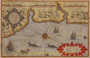
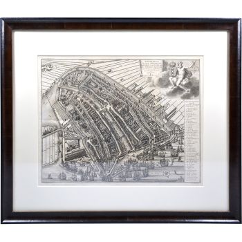
"Willem Janszoon Blaeu e seu filho Joan resumiram a 'era de ouro' da cartografia holandesa. Trabalhando durante o século XVII, Willem Blaeu desenhou uma série de mapas inovadores e publicou o primeiro atlas.
Ele nasceu em 1571 em Amsterdã e trabalhou inicialmente como balconista no comércio de arenque da família. No entanto, ele não estava feliz com sua ocupação e saiu de casa em 1594 para estudar matemática com Tycho Brahe, o famoso astrônomo. Blaeu era um bom aluno que impressionou muito seu tutor e, quando seus estudos terminaram, ele voltou para Amsterdã e abriu um negócio como cartógrafo. Seu negócio floresceu e sua reputação cresceu. Ele foi o primeiro cartógrafo a produzir mapas de folha única de muitos países europeus.
Em 1605, ele fez um mapa-múndi de parede, contendo 20 folhas, cada uma com 2,5 metros de largura. Este mapa foi de longe o mais preciso do período e deu uma contribuição notável para o conhecimento da geografia mundial.
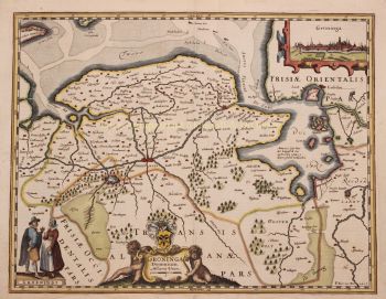
Seu mapa permaneceu o mais preciso até 1648, quando seu filho, Joan, que também se tornou um famoso cartógrafo, o atualizou. Mas sua maior conquista foi a produção do primeiro atlas em 1630. O nome Blaeu era na verdade um apelido de família que Willem adotou depois que ocorreu uma confusão entre ele e seu grande rival Joannes Jansonius.
Você está interessado em comprar esta obra de arte?
Artwork details
Related artworks
- 1 - 4 / 7
Artista Desconhecido
Antique Dutch still life flowers in vase1740 - 1800
Preço em pedidoGallerease Selected
Gobert Denis Chambon/ Jean Janvier, S.G. Longschamps
Magnificient antiek World map1754
€ 17.500Inter-Antiquariaat Mefferdt & De Jonge
Com curadoria deDanny Bree
1 - 4 / 24- 1 - 4 / 24
- 1 - 4 / 24
- 1 - 4 / 12


