Curated Curiosities: An Unique Pair of Library Globes by Willem Blaeu
For over thirty years, Theo Daatselaar managed to acquire works of art and antiquities of the utmost quality. His name is well-known and renowned in the art world. Theo Daatselaar, who runs the firm together with his daughter Ilse, has a undisputed taste and talent for treasures and offers his clients a wide range of magnificent pieces, from old masters to 19th and early 20th century paintings, 18th and early 19th century furniture, European and Asian ceramics, sculpture, antique silverware and - last but most certainly not least - instruments.
Although it is difficult to select a single work of art from this variety of splendour and quality, one item (or, strictly speaking, two items) absolutely deserve to be highlighted with emphasis. Gallerease would like to draw your attention to an excellent and unique pair of 17th century globes by the grand Dutch cartographer Willem Blaeu, published by his son Joan Blaeu. This matching pair of globes is of the utmost importance and belongs to the largest pair ever made in Amsterdam in the first half of the 17th century. Each sphere - one a terrestrial globe, the other one a celestial globe - has a cross-section of 68 cm; including the similar stands, the globes have a height of 100 cm and a width of 88 cm.
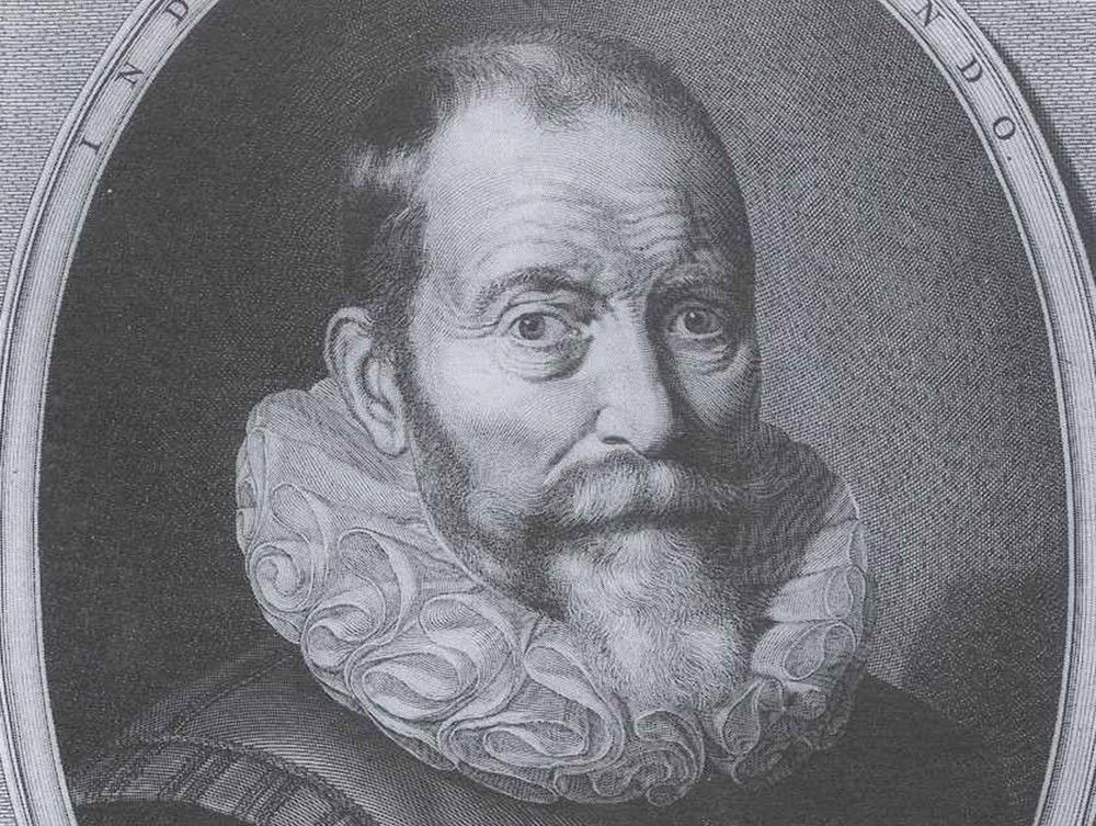
Willem Janszoon Blaeu
Willem Janszoon Blaeu (1571-1638) is one of the foremost cartographers, atlas makers and publishers in history and is regarded as the father of modern western globe-making. He can be held responsible for the rise of globe making as a viable commercial enterprise; the globes Blaeu produced during his forty-year career are without any doubt amongst the very finest and most beautiful ever published.
Born in Northern Holland, possibly Alkmaar, as a son of a well-to-do herring merchant, Willem Blaeu was initially destined to follow in his father’s mercantile footsteps; however, the young Willem was much more interested in mathematics and astronomy rather than the herring trade and apparently - luckily - managed to persuade his father. Over the winter of 1595-1596, Blaeu was a student of the renowned Danish astronomer Tycho Brahe (1546-1601) at his observatory in Urienborg. Brahe - whose portrait surmounts the cartouche on the celestial globe - was the leading astronomer of his day and the first in the West to produce an entirely new star catalogue since Ptolemy. After having discovered the skills and secrets of instrument making, cartography and astronomy, Blaeu went back to his hometown Alkmaar, but already in 1599 he moved to the booming metropolis Amsterdam, then at the dawn of its Golden Age.
It was in Amsterdam that Willem Blaeu established his immensely successful publishing company which, throughout the course of the seventeenth century, would issue not only globes and other instruments (his house was called “In de Vergulde Sonnewijser”, meaning “in the gilt sundial”), but also exquisite maps, books (notably on the topics of astronomy, cartography and navigation), atlases and planetaria.
The maritime expansion of the Netherlands in the 16th and 17th century caused a very keen interest in and a serious demand for geographical and astronomical know-how. The Dutch strive for endeavours across the seas and oceans stimulated and spurred the rapid rise of the “cartography industry” in the Golden Age. The production of globes - terrestrial as wel as celestial spheres - was particularly important for educational, geographical and astronomical purposes; in the early 17th century, the university of Leiden, the oldest university of the Dutch republic (founded in 1575), owned three pairs of globes, made by Gerard Mercator, Jodocus Hondius and Willem Blaeu. Not surprisingly, the globe makers encouraged and promoted such education; especially Willem Blaeu’s “Tweevoudigh onderwijs van de hemelsche en aerdsche globen” (“Dual education of the celestial and terrestrial globes”, a book first published in 1633 and reprinted many times) became the leading educational publication on that topic.
Apart from globes, Blaeu, who was appointed official map-maker of the Dutch East Indian Company (V.O.C.) in 1633, is particularly known for his maps in an atlas format, which were published in his spectacular “Novus Atlas” or “Theatrum” (1635), with no less than 208 (or, depending on the edition, 207) different maps, published in Dutch, German, French and Latin - not in English, as in those days, Latin was the scientific ‘lingua franca’ and French was still the language of the cultivated...
Johannes (also known as Joan) Blaeu (1598-1673), the eldest son of Willem, would continue the cartography and publishing business after his father’s death in 1638, in first instance together with his younger brother Cornelis, who died in 1644. In 1646, a French visitor of Amsterdam, described the printing company of Joan Blaeu, situated on the Bloemgracht, as “l’imprimerie la plus belle de toute l’Europe” (“the most beautiful printing company of whole Europe”). Joan Blaeu, who studied in Leiden and Padua and had obtained a Doctorate in Law, would become equally renowned as his father, especially by his “Atlas Major” - the ‘Great Atlas’ of the world, a masterpiece published in 1662.
Terrestrial globe
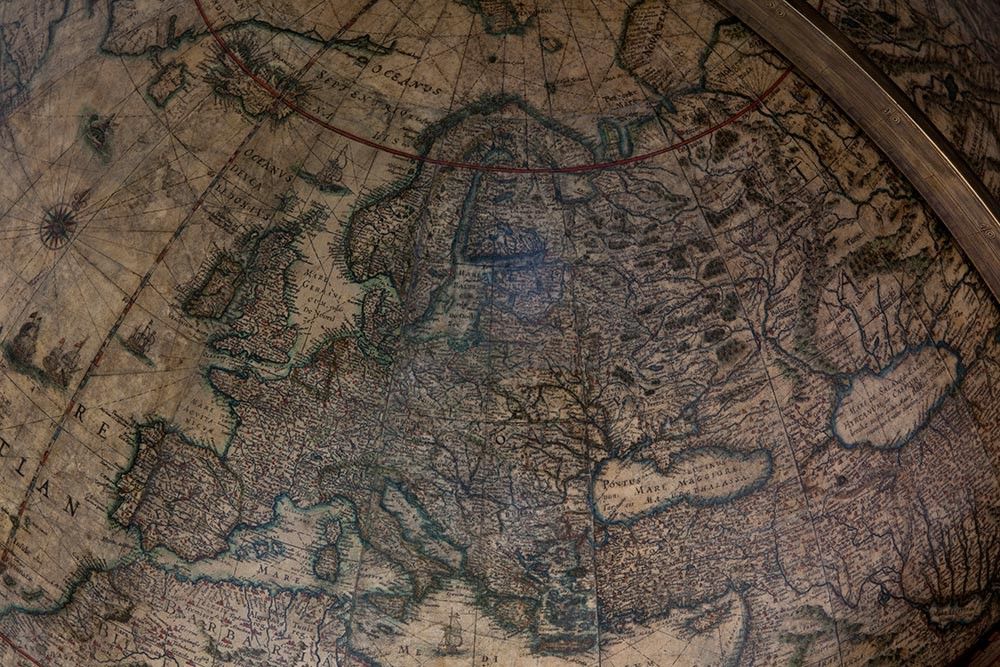
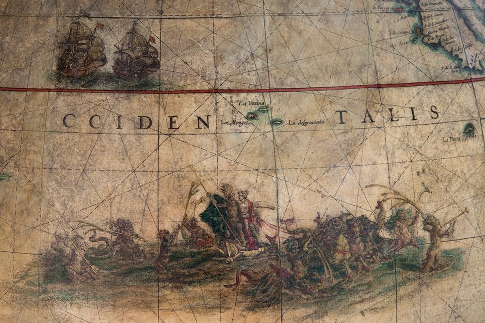
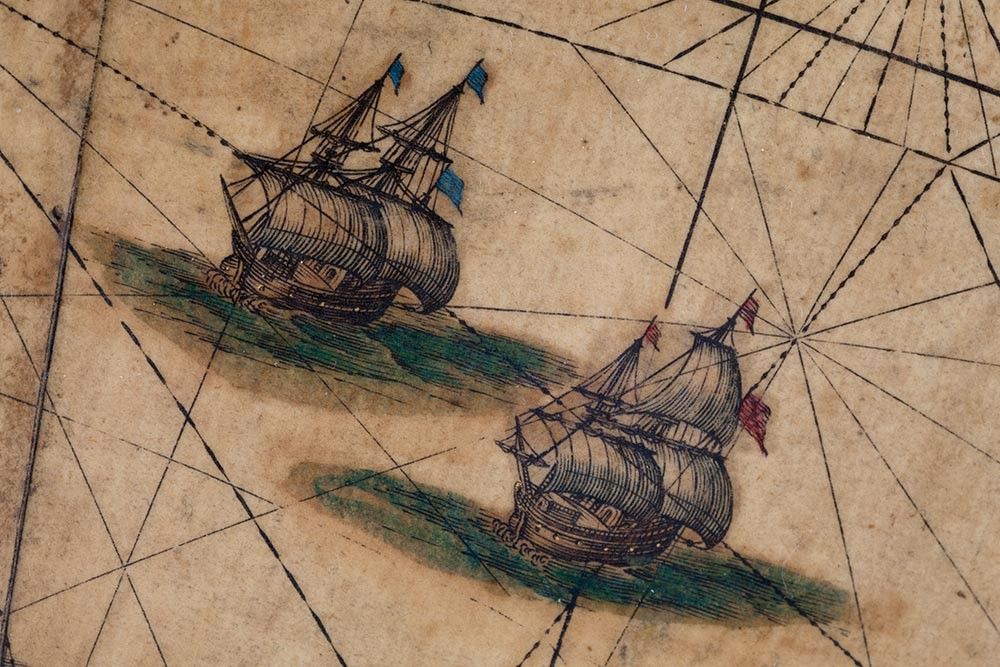
Blaeu’s terrestrial globe (or, in Latin, “sphaera mundi”) is signed “Guiljelmus Blaeu Auctor. Anno 1622” (“Guiljelmus”, also Guilielmus, is the Latinisation of the Dutch name Willem); it concerns a so-called fourth state, which can be dated 1645-1648. The globe is made out of 36 hand-coloured engraved half gores and two polar calottes, pasted onto a plaster sphere, with a detailed and inscribed cartouche to each hemisphere. In the 17th century, it was perfectly possible - and even preferred - to combine science with aesthetics and other practical information: the seas are decorated with ships and sea monsters, as well as with wind-roses and shipping routes - the Dutch republic was of course a naval power. On the continents, all decorated with animals, figures and monsters, the spectator can see the various mountains, rivers and towns, all named in Latin. It is intriguing to note that the great wall of China is represented pictorially; California is shown as an island and the globe even shows a fictitious island labelled “Frisland”.
Without any doubt, this terrestrial globe is a beautiful and also fascinating work of art, which cannot only be admired hugely, but deserves to be studied with attention as well. It is mind blowing and almost incredible that in an era without aviation and without satellites, people were actually capable of accomplishing such a hugely accurate map of the world.
Celestial globe
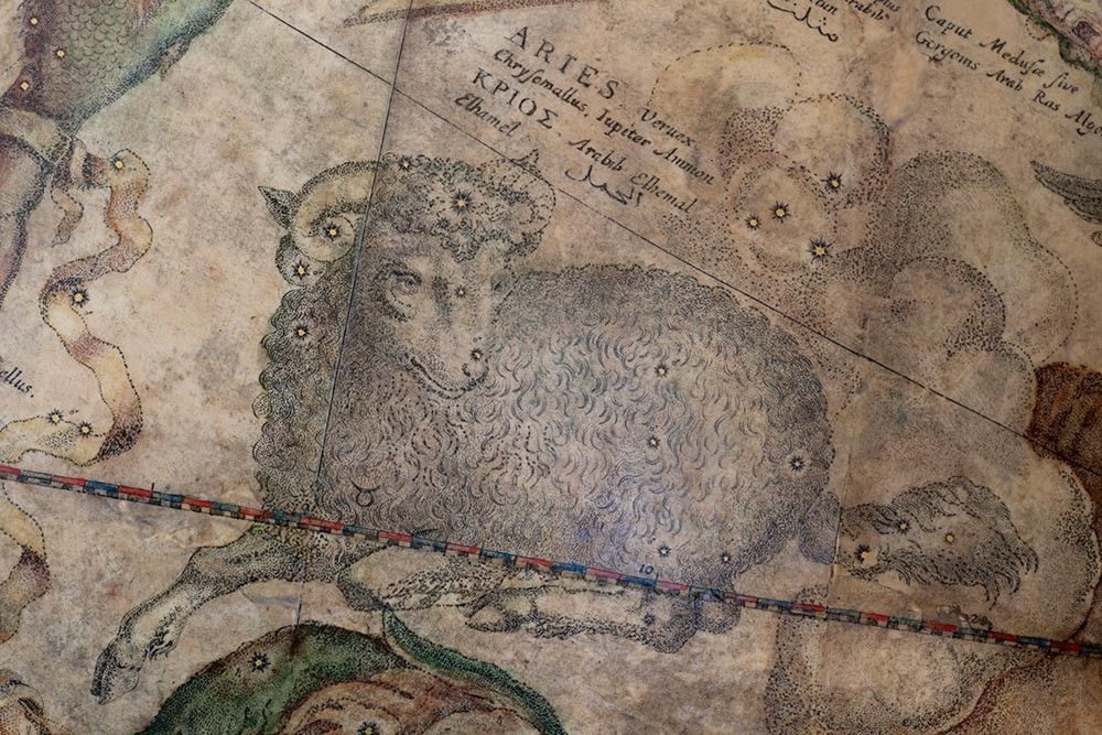
Equally captivating and stunning is the celestial globe (“sphaera stellifera”, as it was known in Latin), which maps the constellations on the outside of the sphere, thus resulting in a mirror image of the constellations as one could see from earth. This sphere is again signed in the advice to the reader by its maker (“Guiljelmus Blaeuw”) and is dated in the cartouche “1640”; this sphere concerns a third state globe. By all means, Blaeu always attempted and often managed to be as up-to-date as possible, including all sorts of new celestial discoveries. To receive new, trustworthy and independent information, which would be unknown to his biggest competitor Jodocus Hondius. For instance, Blaeu requested the famous Dutch explorer (and astronomer) Frederik de Houtman (1571-1627) to write down his own observations during his passage to the East Indian Archipelago, thanks to which Blaeu could publish his second new globe (1603) with various newly discovered stars.
The celestial globe is made up out of 24 hand-coloured engraved half gores, again pasted on to a plaster sphere. A detailed and inscribed cartouche is surmounted by a portrait of Tycho Brahe - the former tutor of Blaeu. The constellations on this globe follow the system and style as established by Blaeu’s illustrious predecessor Gerard Mercator (1512-1594), the famous Flemish geographer and cartographer, renowned for creating the world map on a new projection. They are engraved with texts in Latin, Greek and Arabic, giving alternative names. The stars are categorized to six levels of magnitude and are picked out in gold paint and the nebulae (diffuse astronomical objects, including galaxies) are given a separate symbol and are indicated in notes without a cartouche.
Both globes are placed on a parcel-gilt and grained imitating rosewood Dutch-style stand with four turned baluster supports above a circular moulded base, with a cross-stretcher resting on an oak wood triangular support and with bun feet. The spheres are supported by a messing meridian with hour ring and pointer and the hand-coloured engraved horizon carries both the Julian and the Gregorian calendars, with Saints’ days, the houses of the Zodiac, the wind directions and a degree scale.
Arabic script in 17th century Amsterdam
As said, the names on the celestial globe are not only mentioned in Latin and Greek but in Arabic script as well. The Blaeu globe is the only 17th century globe with Arabic texts on it - absolutely unique in that era, althought justly and not coincidentally: after all, astronomy made great progress thanks to the science of the medieval Islamic world, an amalgamation of Greek, Sassanid and Indian astronomical science. It was Maliq-Shah I (1050-1092), sultan of the Seljuq Empire, who founded the first large observatory and already in the 11th century, globes were made in the Arabic world. Thanks to Arabic astronomers, Europe was able to ‘recover’ the knowledge of Greek astronomic intelligence, supplemented with priceless Arabic expertise and new discoveries.
Last but not least, it’s not that surprising: Amsterdam has always been an ‘open-minded’ town, a port city with merchants and shipowners, where people from all around Europe and beyond - and with various religions - were welcomed. In 1612, Ahmed I (1590-1617), sultan of the vast Ottoman Empire, closed an important trade agreement with the Dutch Republic (and soon, Ottoman traders settled in Amsterdam; in 1625 the “Direction of the Trade and Navigation on the Levant and the Mediterranean Sea” (“Directie der Levantsche Handel en Navigatie in de Middellandse Zee”) was founded in Amsterdam, with its office in the Stadhuis (nowadays the Royal Palace) on the Dam square. And let’s not forget that the tulip - the Dutch symbol ‘par excellence’ - was only imported from the Ottoman Empire (Turkey) in the late 16th century!
Scientific ‘must-have’
One might say globes like these have always been scientific as well as prestigious ‘must-haves’, not only for the Dutch mercantile gentry and plutocracy, but also for the European aristocracy. Few courts - whether in London, Paris, Vienna or Dresden - will have known libraries without globes of this sort, often by Willem Blaeu; the “Atlas Major” by Joan Blaeu no doubt wasn’t absent either: Blaeu was almost the synonym of cartography.
This pair of globes, offered by Daatselaar Fine Art & Antiques, has such an illustrious provenance: until recently, they belonged to the private collection of the Princes of Liechtenstein and until 2006, the globes could only be found in the princely palaces in Vienna - first in the baroque Gartenpalais, afterwards in the adjacent princely summer residence and belvedere, the Alserbach Palais.
The fourth and third states are the most attractive combination of these Blaeu globes. Several comparable pairs of globes have already been secured, guarded and cherished in museums (amongst others the Rijksmuseum in Amsterdam, the Staatliche Kunstsammlungen in Dresden and the Metropolitan Museum of Art in New York) and private collections worldwide. It is absolutely an exceptional and rare opportunity to find a pair of globes of such a very fine quality these days. Currently, no other pair of globes of this size and quality is offered anywere on the market.


